
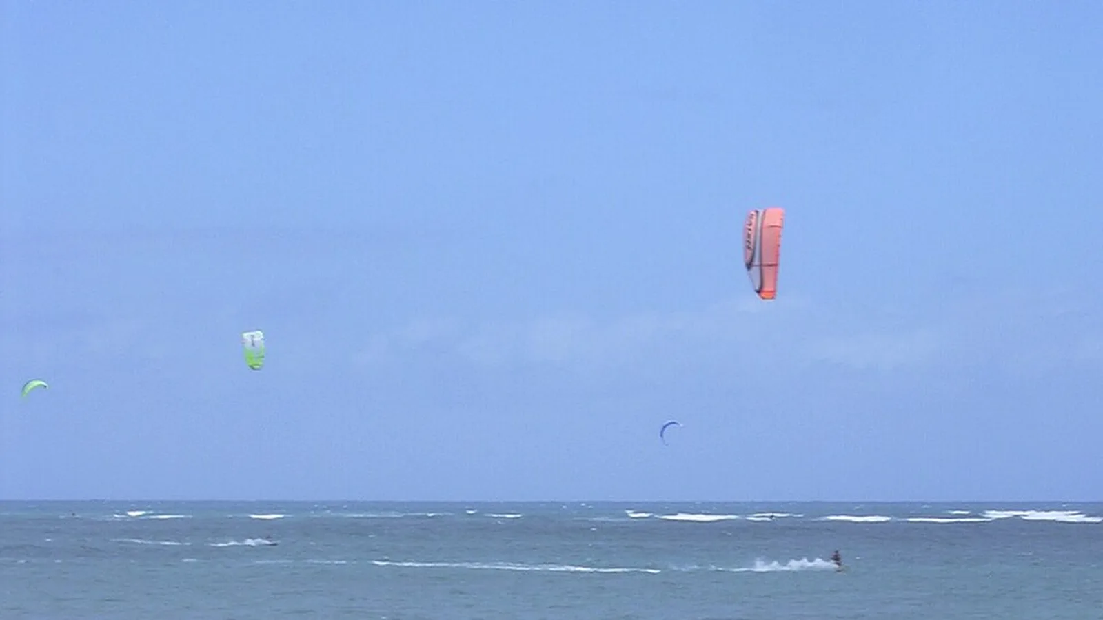
Photo: Forest & Kim Starr / Wikimedia Commons, CC BY 3.0
From Hawaii's trade wind to the Columbia's venturi, every US spot runs on a different wind mechanism — and its own set of rules.
Kanaha Beach, Maui: the most reliable north-east trade wind in the US, on up to 95% of summer days.
Kanaha in detail arrow_forward
Cape Hatteras (North Carolina), South Padre Island (Texas) and Miami/the Keys (Florida): three flat-water spots, three different seasons.
The East Coast in detail arrow_forward
San Francisco Bay (California) and the Hood River venturi (Oregon-Washington): two demanding spots, not to be underestimated.
The West Coast in detail arrow_forwardSix spots, six wind mechanisms, no single federal rule.
The list above is the wind map. The Atlantic coast and the middle of the Gulf work differently — swell-led, seasonal, and governed by a denser tangle of authorities than anywhere else in the country. Twenty more guides cover it, including the freshwater Great Lakes coast:
The most reliable north-east trade wind in the United States, on Maui.
Kanaha Beach (also known as "Kite Beach"), in Kahului, owes its reputation to the north-east trade wind funnelled between the Haleakalā massif and the West Maui Mountains, boosted by the afternoon thermal. The wind blows 15 to 25 knots, rideable on up to 95% of summer days: roughly 22 knots on average in summer, 19 in spring, 17 in autumn and 15 in winter. The best season runs from May to October, in a north-east to east sector.
The spot combines an exposed coral reef — dangerous at low tide, with buried rocks in places — and strong currents; an east/south-east wind can create a wind shadow. It's a busy, mixed-level spot: the outer area leans intermediate to advanced, while beginners are taught by schools on more sheltered sections. This isn't a pure flat-water spot like South Padre Island or the sound side of Cape Hatteras. The water stays warm year-round (24-25°C in February, 26-28°C at the September peak): a rash vest or boardshorts are enough most of the year, with a top or shorty wetsuit only useful at dawn, dusk, or in cool wind.
See on Google Maps open_in_newAction Sports Maui, which describes itself as the island's only IKO/PASA-accredited school for over 29 years, teaches at this spot. Kahului Airport (OGG) is about 8 miles away, a 2-minute taxi ride.
Regulations: per guidelines published by Action Sports Maui (a single operator source, not cross-checked against an official document — a repeat attempt to load that page failed), an orange flag marks the furthest upwind point for launching or landing, and kites shouldn't be flown above 125 ft — a limit plausibly tied to Kanaha's proximity to OGG airport, though no FAA or Maui County document confirms it. Spot guides also describe a time-slot split between kiters and windsurfers. No official Hawaii state regulation was found for this spot. See our full Hawaii guide for Oahu's Kailua Bay and North Shore spots, and a real, unresolved regulatory contradiction at Kailua worth knowing before booking a lesson there.
Three flat-water spots, three wind regimes, three different seasons.
Unlike Hawaii, the wind at Cape Hatteras follows mixed synoptic patterns rather than a thermal effect: spring mixes south-west and north-east wind, while summer sees the north-east fade in favour of a dominant south-west. The season runs April to November, most reliable in April-June and September-November, with June-July the most consistent months. The main spots — Canadian Hole/Haulover, Kite Point, Salvo, Waves/Rodanthe — sit on the sound side, on Pamlico Sound: flat, shallow water for miles, considered one of the best beginner spots in the country on a north-north-west to north-east wind. The National Park Service's own page flags overhead obstacles (power lines near the road) and advises watching for changing weather; no specific shark, current or shoal hazard information was found for these sound-side launches. The water stays warm through about mid-October; in winter, sources give a range of 8 to 20°C depending on the month and exact spot — a 4/3mm or 3/2mm wetsuit with boots is then recommended.
REAL Watersports (in Waves) is described as the anchor of the whole Hatteras kite scene and the largest kiteboarding school on the US East Coast (50,000+ students since 2001), with on-site lodging and intensive camps. There's no airport on the island: the nearest is Norfolk International (ORF), about 115-150 miles/2h15-3h45 by car depending on the spot. See our full North Carolina guide for Frisco, Ocracoke, Corolla, Duck, and the spots further south.
See on Google Maps open_in_newHere, the dominant south-east trade wind is boosted by a strong late-spring/summer thermal (20-25 mph most afternoons), for a general range of 15-30 mph. The best months are March-July and mid-October to November. On the bay side, the Laguna Madre is flat, with standing depth for miles — a classic beginner flat-water spot. The most documented hazard is the wake from large vessels ("tanker waves"), which also briefly block the wind: best to exit the water as one approaches. On the Gulf side, more technical waves attract advanced riders in winter. The water drops to 17-21°C in early February (a 3/2mm wetsuit is recommended then), and needs no wetsuit the rest of the year.
Air Padre Kiteboarding (since 2003), ProKite South Padre and H2O Sports (IKO-certified) teach here. The nearest airport is Brownsville South Padre Island International (BRO), about 25 miles/30-45 min away; Valley International in Harlingen (HRL) is about 46 miles/55-60 min away. One source states that all the island's beaches are open to kiteboarding with no launch restrictions, but this is a casual guide, not a Cameron County or Texas General Land Office document — treat it as unverified. See our full Texas guide for North Padre Island's Packery Channel, and a real National Seashore ban worth knowing before you go.
Louisiana's coast doesn't fit the flat-water pattern above, and we're not going to pretend it does. Most of it is marsh and barrier-island wetland, not open sand, and there's no equivalent of a Cape Hatteras or a South Padre Island here. Grand Isle, the state's one inhabited barrier island and the site of its only state-owned Gulf beach, has a real but modest water-sports rental scene — Jefferson Parish's own tourism page names a surfboard-rental and lesson operator (Pontcha Surf Club) and a paddleboard outfitter (Calypso Paddle Company) at Grand Isle State Park, and mentions kiteboarding without naming an operator for it. Holly Beach ("the Cajun Riviera"), further west in Cameron Parish, is a genuine if small storm-swell surf spot, best known in September. Neither is a kiteboarding or windsurfing destination on the numbers, and measured search volume here is thin even next to Georgia's already-modest figures. See our full Louisiana guide for what's actually there, and what we couldn't confirm.
Here, it's the reverse: the season is driven by winter cold fronts, not a thermal or trade-wind mechanism — October to April, opposite the other US spots on this page. Average wind is 15-20 knots, 20-25 behind a front. At Crandon Park (Key Biscayne, Miami), clear, shallow water turns to seagrass further out; entry and exit must go through a marked channel between lifeguard stands N5 and N6, staying clear of the shoreline and the protected seagrass beds. At Key West (Smathers/Higgs Beach), the water is calm and jetty-protected; the Mud Keys, about 15 miles away, offer more remote, mangrove-lined flats. The water stays warm year-round (24-29°C), with a brief drop to around 16°C possible after a strong cold front.
Crandon Park is restricted to advanced riders by its own access rule (see the regulations section below) — not a beginner spot despite its flat water. Key West, by contrast, also suits beginners, with schools like UpWind Kiteboarding teaching them in 3 to 5 lessons; Miami Kiteboarding and East Coast Kiteboarding run lessons at Crandon Park, while Key West Kiteboarding and Otherside Boardsports operate in Key West. Miami International Airport (MIA) is about 12-16 miles from Crandon Park (22 min by car); Key West International (EYW) is about 1 mile from Smathers Beach — one of the shortest airport-to-beach distances in Florida.
Two demanding spots, between a bay thermal and a canyon venturi.
These three spots share the same thermal mechanism — warm Central Valley air pulls cool marine air through the Golden Gate — strongest March to October, peaking May to September. Crissy Field, right in the city, is highly gusty (a range as wide as 5-45 mph in a single session per one source), close to the Golden Gate shipping channel — hence the common, though not officially confirmed as a written rule, practice of monitoring VHF on the Coast Guard and vessel-traffic channels. It's explicitly described as not recommended for beginners. Third Avenue has no wide bail-out beach and runs informal rules set by a local group of riders, not an authority. Sherman Island, in the Delta, is the most approachable of the three: steadier wind, warmer air, several schools on site (Kitopia Kiteboarding School, Edge Kiteboarding). The water stays cold year-round at Crissy (typically 12-16°C, up to a 7-24°C range depending on season and location within the bay): a 4/3mm full wetsuit is needed year-round, with 5/4mm or 5/3mm plus gloves, boots and a hood at the coldest point (around August).
San Francisco Airport (SFO) is 20-30 min from Crissy Field. For Sherman Island (Rio Vista), the nearest airports are Sacramento International (SMF, about 54 miles/1h16), Oakland (OAK, about 63 miles) or SFO (about 73 miles/1h39).
See on Google Maps open_in_newThe Cascades' canyon funnels cool marine-side air toward the hot high-desert side, creating a genuine wind tunnel boosted by a strong thermal: the wind blows almost daily from May to September, averaging 15-30 knots, with gusts sometimes exceeding 50 mph on strong days. Unlike the other spots on this page, these are river conditions, not ocean ones: current combined with wind can push an underpowered rider toward the road bridge, whose pilings are described as extremely dangerous, and the confluence of the Hood River with the Columbia is flagged as a potential trap for swimmers and riders. The launch site matters a great deal: the Event Site beach is reserved for experts, while beginners and intermediates are directed to the Sandbar. The water is cold (about 11°C in late April, requiring a full wetsuit, hood and boots; about 26°C by September 1).
Kite the Gorge (IKO instructors) and Gorge Kite & Wing (operating since 1999) teach at the Sandbar — teaching there is restricted to schools licensed by the Port of Hood River. Portland Airport (PDX) is about 58 miles away, roughly an hour's drive.
Regulations: per the Port of Hood River, launching and landing from the Event Site, or riding within its safety zone, is prohibited from May 1 to October 1; its grass area is open for launching only outside that window. Oregon's new Waterway Access Permit (2026, for SUPs/kayaks/rafts) explicitly does not apply to kiteboards, according to a 2026 local news report.
There's no US equivalent to France's Division 240.
In the United States, no single federal law governs kiteboarding the way France's Division 240 does. Each spot falls under a different regime: a national park (Cape Hatteras National Seashore, which lists approved locations with no permit or fee identified beyond general weather awareness), a port authority (the Port of Hood River, which bans launching from the Event Site in high season), a county or park running its own access rules (Crandon Park in Miami, which requires an advanced certification and a marked launch channel), or simply no rule identified at all (South Padre Island, Key West).
A rule specific to one spot or park never automatically applies to another: a seasonal closure to protect nesting shorebirds exists, for example, at Cape Cod National Seashore (Massachusetts), but was not found for Cape Hatteras — don't transplant one to the other. Always check the rules specific to the spot you're visiting with its local managing authority.
In a sea emergency, contact the US Coast Guard (VHF channel 16) or 911.
What riders ask most before heading to the United States.
The sound side of Cape Hatteras (Canadian Hole/Haulover) and the Laguna Madre at South Padre Island both offer flat, shallow water for miles, ideal for learning. In San Francisco Bay, Sherman Island is the most approachable of the region's three spots.
No. Each spot falls under its own regime — national park, county, port authority, or no rule identified. A rule seen at one spot doesn't automatically apply elsewhere, even at a similar type of park.
It depends on the region: Hawaii, Hood River, San Francisco Bay and Cape Hatteras broadly run May to October (thermal/trade season), while South Florida is the opposite — October to April, driven by winter cold fronts.
Crandon Park, in Miami, requires a minimum advanced-level certification by its own access rule. Hood River's Event Site is expert-only. Crissy Field, in San Francisco, is explicitly described as unsuitable for beginners due to gusty wind and shipping traffic.