

📍 Puerto Rico, United States
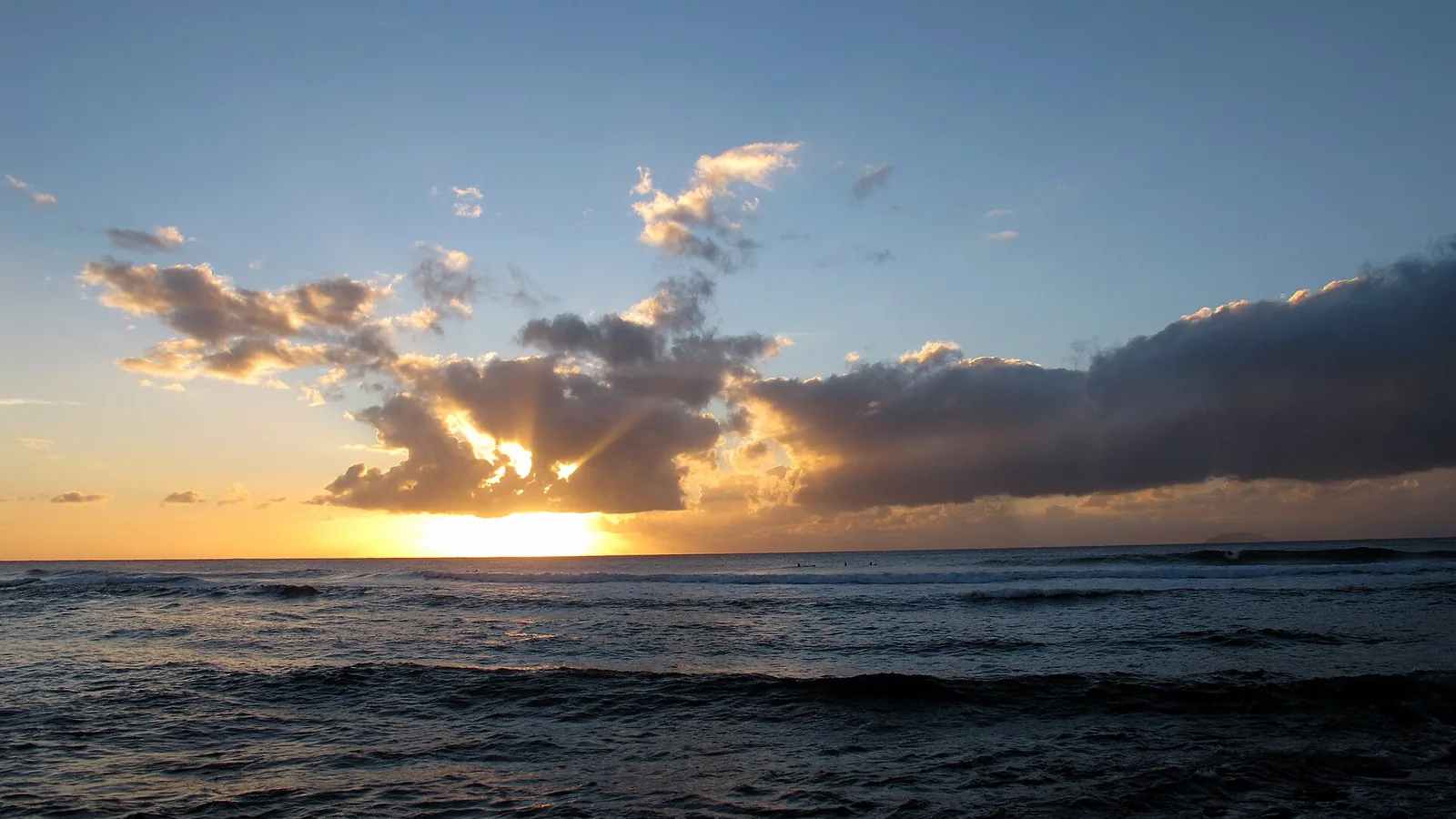
Photo: M S / Wikimedia Commons, CC BY-SA 2.0
The west is surf. The north is kite. Both run on winter, and the summer difference between them is the whole planning decision.
The west-coast reefs: Tres Palmas, Domes, María's, Wilderness. Surf, not kite — and dead in summer.
The west coast arrow_forward
Ocean Park and Isla Verde for urban kiting; Shacks is the one genuinely multi-sport spot on the island.
The wind spots arrow_forward
Puerto Rico had more surf-zone deaths than any US state in 2024. The named beaches are the spots.
Read this first arrow_forwardPuerto Rico's surf comes from North Atlantic winter lows sending long-period north to north-west groundswell onto an island whose north and west coasts face straight into it. Rather than repeat a guide's adjectives, we went to the NOAA buoy records off Rincón and San Juan and counted the hours, 2021 to 2025.
| Month | Hours over 1.5 m at Rincón | Dominant period | What that means |
|---|---|---|---|
| December | 29% | 10.5 s | The peak |
| February | 23% | 10.1 s | Groundswell season |
| April | 13% | 10.0 s | Fading |
| May | 1% | 8.8 s | Effectively over |
| June | 0% | 6.9 s | Flat |
| July | 0% | 6.5 s | Flat |
| September | 9% | 9.7 s | Returning |
June and July recorded zero hours above 1.5 m across five seasons. The dominant period tells the same story from the other direction: around 10.5 seconds in winter, which is groundswell, collapsing to 6.5 seconds in midsummer, which is local windslop. Anyone selling you a July surf trip to Rincón is selling you a flat ocean.
Wind runs on a different clock, with two peaks. At the San Juan buoy, hours at or above 15 knots peak in February (28%) and again in June and July (22–23%), with a sharp minimum in September (6%) and October (4%). Commercial kite sources disagree about this — some say the season is December to April, another says late spring and summer — and the buoy record supports neither alone. The practical reading: winter gives wind and waves together, early summer gives wind on flat water, and September–October gives neither, which is also the peak of hurricane season.
Atlantic hurricane season runs 1 June to 30 November, peaking around 10 September. The worst month to book is not in dispute.
One thing you will not need: a wetsuit. Water runs about 27 °C in February and 30 °C in September, and the coldest reading at any Puerto Rico station in 2025 was 25.8 °C. A rash vest for sun and reef is the real requirement.
This is surf country and not kite country — the same north-west groundswell that lights the reefs arrives with light, variable local wind.
A big-wave outer reef that does not start working until it is well overhead, and has been ridden at 25 to 30 feet. Expert only, and genuinely inconsistent — one forecasting service rates it as producing clean surfable waves around 7% of the time even in January. It breaks over living elkhorn coral.
Domes is the most consistent break in Rincón — a right-hand reef point reported to have something rideable most of the time through the winter — and correspondingly crowded. It is named for the decommissioned BONUS reactor dome on the headland, now a museum under the Department of Energy's legacy-management programme; we found nothing either confirming or denying any coastal hazard from it, so we are saying nothing beyond that it is the landmark the break is named after.
María's is the reef pass that hosts the pro-circuit events in winter. Intermediate and up, reef bottom, and very crowded. Sandy Beach is the sand-bottom alternative for beginners and longboards.
The north-west corner — Wilderness, Gas Chambers, Surfer's Beach, Table Tops. Gas Chambers is a shallow-reef barrel and expert-only; Wilderness is advanced. January to April is the best window. Sea urchins are heavily and repeatedly flagged here, along with flat rock bottom and rips: booties are not optional.
Crash Boat, named for the WWII crash-rescue boats that worked from its pier, is mostly a swimming and snorkelling beach with occasional surf — and an active boat ramp and pier, so treat the traffic seriously.
You will see Punta Borinquen described as a World Surfing Reserve, designated in 2018 as the Caribbean's first. That is an NGO stewardship designation working through community engagement and planning — it is not legal protection, and land beyond the beach remains open to development. Calling it a protected area in law would be wrong.
Side-onshore easterly trades straight onto a two-mile urban beach, with reef outside. Isla Verde suits beginners and intermediates, Ocean Park leans intermediate. The wind peaks in February and again in early summer, and dies through September and October.
It is a very busy swimming beach, and — see the safety section — Condado, immediately west, is the deadliest stretch of water on the island.
Jobos splits in two: a reef break at the point for experienced surfers, and "El Bajo", a sand break mid-beach, for beginners. Best November to March.
Shacks is the one genuinely multi-sport spot on the island — the windiest break in Isabela, with flat lagoon inside and wave-sailing outside, so summer gives flat-water kiting and winter gives waves. It is also an advanced spot with a very shallow reef, where collision with coral is the stated danger.
The east coast's learn-to-surf beach: an exposed sand-bottom beach break that works year-round and best on a north swell. Shorebreak, and rips that build with the swell.
Wind sports, not surf — Mosquito Pier on Vieques goes flat on a north-easterly, Bahía La Chiva on an easterly. One guide states flatly that there is no surf on Vieques. Read the unexploded-ordnance section below before going to either island.
Puerto Rico is an unincorporated US territory, so there are three layers here — federal, Commonwealth and municipal — and they are not interchangeable. If you have read our Spanish or French destination pages, put those rules out of your mind: there is no distance-from-shore limit here, and no equivalent of the town-by-town kitesurf ordinances that cover the Andalusian coast.
The governing statute is Ley Núm. 430 de 21 de diciembre de 2000, the Ley de Navegación y Seguridad Acuática. Its Article 3 defines a vehículo de navegación to include, in terms, "tablas para flotar con o sin vela" — boards that float, with or without a sail. That plainly covers a paddleboard and a windsurf board.
Article 7 then prohibits navigation vehicles from operating, transiting or anchoring inside areas reserved for bathers and inside natural-resource protection areas, which are marked with buoys and bilingual signage. That marked zone is the limit — not a distance. There is no Puerto Rican analogue of the French 300 m rule, and importing one onto this island would be exactly the transplant error we try hardest to avoid.
One unusual provision worth knowing: staying in the water after the National Weather Service issues an adverse-weather bulletin, once ordered out by an officer, is a misdemeanour carrying a $100 to $500 fine. Enforcement falls to the Policía de Puerto Rico, the DRNA's Cuerpo de Vigilantes, the US Coast Guard, Ports Authority security and the relevant municipal police.
Registration attaches to motorised craft. In 2024 the DRNA's Comisionado de Navegación confirmed publicly that kayakers and paddleboarders need neither a navigation licence nor a marbete for non-motorised craft, calling a municipal officer's demand for one an error. We found no permit of any kind for recreational surfing, kitesurfing, windsurfing or SUP anywhere on the island. Commercial operations are different — the DRNA's marine safety division assesses equipment-rental operations and marine events.
In fairness, there is a tension we are not going to paper over: Ley 430's own fee schedule is headed in a way that implies navigation vehicles sit inside the registration scheme, while the agency that administers it says non-motorised craft need nothing. The practical answer for a visitor is clearly "no paperwork", and it comes from the Comisionado rather than from the statute.
This is the genuinely counter-intuitive part, and both halves are true at once. By a US Coast Guard determination of 2008, a paddleboard used beyond the narrow limits of a swimming, surfing or bathing area is a vessel — at which point a Coast Guard-approved life jacket per person, a sound-producing device and a light at night all attach.
So the DRNA says no registration and no licence for your board, and the Coast Guard says that once you leave the surf zone it is a vessel with carriage requirements. A surfer in the line-up sits inside the exemption; a long downwinder does not. We found no rule, federal or territorial, treating a kiteboard as a vessel — Ley 430 does not name kites and the Coast Guard determination is about paddleboards. We are not going to extend either to a kite for you.
Created by Ley Núm. 17 de 8 de enero de 2004, the reserve is a no-take area: fishing and anchoring are prohibited, as is removing shells and dead coral. It exists partly to protect the surf break, alongside endangered elkhorn coral and hawksbill turtle, and surfing there is permitted and promoted by the island's own tourism body. We could not retrieve the text of the law or its 2009 management plan, so the specific perimeter figures circulating online are secondary and we are not quoting them as statute.
Puerto Rico follows the Spanish civil-law zona marítimo-terrestre, not mainland US private-beach norms. The coastal strip washed by the sea is public domain and cannot be privately owned, and public policy guarantees free pedestrian access to it. Las playas son del pueblo is a live political slogan here, not a tourist phrase — there is no comprehensive coastal code, and proposals to shrink the public strip have been fought publicly.
No municipal ordinance anywhere in Puerto Rico naming kitesurfing or windsurfing. We looked in San Juan, Isabela, Rincón and Aguadilla. San Juan's own public-order code could not be retrieved. That is an absence of evidence rather than proof that none exists — but it is a genuine and interesting difference from the Spanish mainland, where this site documents a dense pattern of town-by-town kite rules.
This deserves to be near the top of any honest Puerto Rico guide, so here it is in plain numbers from the National Weather Service's surf-zone fatality record.
| Year | Puerto Rico deaths | US national total | PR share |
|---|---|---|---|
| 2020 | 12 (PR and USVI), all rip currents | — | — |
| 2024 | 13 | 63 | ~21% |
| 2026 (to 19 Aug, preliminary) | 16 | 47 | ~34% |
Puerto Rico recorded more surf-zone deaths than any US state in 2024, and again on preliminary 2026 figures — from a population of about 3.2 million. That is a strikingly disproportionate rate.
And the uncomfortable part: the beaches on the fatality lists are the beaches on the spot lists. The 2024 record names Jobos (twice), Shacks, Montones, La Pared, Condado (twice), La Concha, Escondida, Piñones and Cueva del Indio. Isabela's beaches — Jobos, Shacks, Montones — appear repeatedly, and they are the same beaches marketed as beginner-friendly. Condado and La Concha in San Juan are the most lethal single stretch, and they are a short walk from the Ocean Park kite beach.
We could not establish which beaches actually have lifeguards on duty or when. The DRNA is empowered to run a lifeguard corps; in Rincón a community organisation runs its own water-safety and rapid-response programme, which itself suggests official cover is patchy.
Emergencies: 911. US Coast Guard Sector San Juan on 787-729-6770, or VHF channel 16 at sea. DRNA marine safety on (787) 999-2200.
Both islands were US Navy and Marine training ranges — Culebra until 1976, Vieques until 2003 — and the cleanup is government-documented, unfinished and expected to run to 2032 at a combined cost approaching $800 million. Removals to date run to roughly 32,000 bombs, 12,000 grenades and 1,300 rockets from Vieques, and more than 5,000 unexploded items cleared on Culebra since January 2020.
A major portion of the eastern Vieques wildlife refuge is closed to the public because of that danger, and the former live impact area is closed by federal statute. Only two Vieques beaches — Bahía Corcho and Bahía de la Chiva — have been screened and cleared.
The part easiest to miss matters most to us. An EPA remedial investigation is still running on roughly 600 acres of nearshore water adjacent to 29 beaches either open or being considered for public use. Being washed onto an unsurveyed shoreline, or walking a kite up a beach that has not been screened, is not the same as standing on a cleared one. Stay on beaches marked open, never touch an object found on the sand or in the water, and report it.
What riders ask most before heading to Puerto Rico.
Roughly late October to April, peaking December to March. The buoy record off Rincón shows zero hours above 1.5 m in June and July across five seasons, with the swell period collapsing from about 10.5 seconds to 6.5 — groundswell to windslop. Summer on the west coast is genuinely flat.
No. There is no permit for recreational surfing, kitesurfing, windsurfing or SUP anywhere in Puerto Rico, and registration attaches only to motorised craft — the DRNA's navigation commissioner confirmed as much publicly in 2024. Commercial schools and organised events are a different matter.
No, and this is where European visitors most often go wrong. There is nothing like the French 300 m rule here. The only spatial restriction is that navigation vehicles may not operate inside the buoyed bathing zones or natural-resource protection areas, which are marked on the water and signposted in Spanish and English.
No. It is a no-take reserve — no fishing, no anchoring, no removing shells or coral — and it was created partly to protect the surf break itself. Surfing is permitted and the island's tourism body promotes it as a surf and snorkel site.
No, at any time of year. Water runs around 27 °C in February and 30 °C in September, and the coldest reading at any island station in 2025 was 25.8 °C. Bring a rash vest for sun and reef, and booties for the urchins at Aguadilla.
More than most guides admit. Puerto Rico recorded more surf-zone deaths than any US state in 2024 and again on preliminary 2026 figures, from a population of about 3.2 million — and the beaches on those lists are the same ones on the spot lists, particularly Jobos, Shacks and Montones in Isabela, and Condado in San Juan.
In an emergency call 911; at sea, the US Coast Guard monitors VHF channel 16.