
📍 Washington, United States
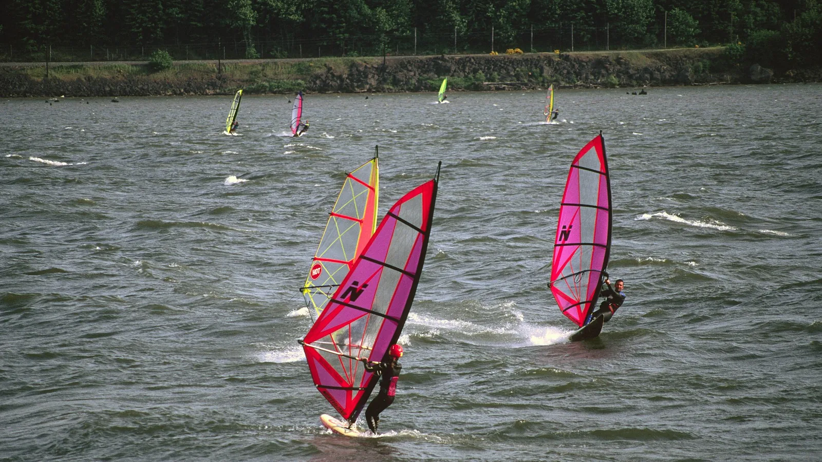
Photo: US Forest Service / Wikimedia Commons, public domain — the same river and the same wind, but photographed from the Oregon bank. We could not find a suitably licensed photograph taken on the Washington side.
The Gorge's north bank is the swell side. Puget Sound is the gentle one. The Pacific coast is cold, and mostly a winter sport.
The Hatchery, Doug's Beach, Maryhill, the Wall — where the swell is, and where the traps are.
The Washington bank arrow_forward
Jetty Island's "Steady Jetty" sea breeze, Golden Gardens and a Bellingham beach you join a club to use.
The Sound arrow_forward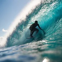
Westport is the state's one reliable surf town. One well-known kite spot is now closed outright.
The coast arrow_forwardThe Columbia River Gorge is the only near-sea-level passage through the Cascades. Air accelerates through it along the pressure gradient between the two sides of the range — and, per the atmospheric-science work on it, mostly through hydraulic effects rather than a simple venturi. In the warm season the subtropical ridge sits offshore while a thermal low forms over the hot Columbia Basin, so the gradient drives a westerly that strengthens through the afternoon. In the cool season it reverses, and cold basin air drains west.
Washington State Parks puts the wave mechanism plainly in its own description of Spring Creek Hatchery: "Strong west winds drive against the river currents, creating big swells and frothy whitecaps." That is the Gorge in one sentence — wind against current, on a river.
The practical split between the banks: on a given day the Oregon side is the flatter, more sheltered, learner-friendly one and the Washington side is the swell side. The Washington bank carries the Hatchery, Swell City, Doug's Beach, Maryhill and the Wall — all rated advanced to pro. The one genuine beginner venue on this bank is the Lyle Sandbar.
Because the Gorge straddles a state line, the bank decides which state's rules, parks and passes apply. Two of the most-cited English-language Gorge guides get this wrong in opposite directions: one states that Doug's Beach and the Hatchery are on the Oregon side — both are Washington state parks — and another files Home Valley, Roosevelt and Avery under an "Oregon side" heading, when all three are in Washington counties. If you read a bank attribution elsewhere that contradicts this page, check it against the state park record or the county.
| Launch | County | Notes |
|---|---|---|
| Stevenson, Bob's Beach, Home Valley | Skamania | Free sandy launch; works on west or east wind |
| Spring Creek Hatchery ("the Hatchery") | Skamania | Advanced–pro; historic competition venue |
| Swell City | Skamania | Private, members only. No kite launch. |
| Bingen Marina / Bingen Point | Klickitat | Flatter, intermediate; watch barge traffic |
| Lyle Sandbar ("the Klick") | Klickitat | The beginner spot on this bank |
| Doug's Beach | Klickitat | Skill level disputed — see below |
| Avery, Maryhill, the Wall, Roosevelt | Klickitat | Advanced–pro; strong to very strong current |
It appears in every "best of the Gorge" round-up, so this is worth stating clearly. Swell City is privately owned by the Columbia Gorge Wind & Water Association and open to supporters only, on a seasonal launch pass costing $90 — one pass per launching person, not per vehicle, collected in person in Hood River. And the association's own page says it plainly: "There is no safe kite-launch at Swell City." It is a windsurf, wing, foil and paddle site. Turning up with a kite is a wasted trip.
Washington State Parks describes Doug's Beach as offering excellent windsurfing but warns visitors to "be prepared for expert level conditions due to high winds and choppy sometimes white-capped waters," and adds that high winds and rough, fast river water may make conditions dangerous. Klickitat County's own page says the opposite emphasis: that protected near-shore areas provide comfort for beginners.
Two official sources, contradicting each other. The likely reconciliation is that they are describing the sheltered inside and the exposed outside of the same site, but we could not find that stated anywhere, so we are reporting both rather than picking one. Treat the water beyond the near-shore strip as expert.
Lyle is the exception on this bank: a large sandbar where the Klickitat River meets the Columbia, shallow and standable a long way out, with steadier and less gusty wind than the swell sites — roughly 15 to 35 knots from June to early September. Watch for submerged stumps and branches. Access involves crossing SR-14 and the BNSF line; local guidance is that crossing the tracks is illegal at several Gorge launches, though we could not find the railway or regulator citation behind that.
The Wall, opposite Rufus near Maryhill, is the Gorge's premier swell spot — the biggest water and the biggest jumps, advanced to pro, with strong to very strong current. Its own spot write-ups warn to "watch for fish nets and rocks", which is not a throwaway line on this river (see below). One guide states that kiting is not permitted there; we could find no rule or landowner behind that, so treat it as a local convention rather than a sourced prohibition.
The region's genuine beginner kite spot, and unusually, an officially recognised one: the Port of Everett lists kiteboarding on the west side of the island, spring and summer, weather permitting. The draw is a near-daily afternoon sea breeze — side-onshore from the north-west, roughly 15 to 18 knots, from May to September, arriving any time between 2 and 7 p.m. Local riders call it the "Steady Jetty".
The water helps as much as the wind: Port Gardner Bay is a gently sloping sandy tidal flat fed by the Snohomish River, shallow enough to stand a long way out and several degrees warmer than the rest of the Sound. Access is by foot ferry during Jetty Island Days in July and August, or by your own craft year-round.
One genuinely odd hazard, documented by the Port: ghost-shrimp burrows cause unexpected sinking when walking on exposed mud at low tide. There are no lifeguards. Note also that the kite zoning riders actually follow — stay north of the sign, rig in the far northern sand, keep well clear of the swimming area — is a community and school convention agreed with the Port, not a posted regulation.
Strictly wind-direction dependent: rideable on a northerly or north-westerly, and shadowed by the marina and the bluff otherwise. Any easterly component shadows the launch and makes getting back to the beach difficult. Add pilings at the north end that vanish at high tide, strong currents, and the north entrance of Shilshole Marina immediately south — this is not a forgiving site, and the beach is crowded in summer.
Shallow water and clean, unobstructed wind, best at lower tides. Access runs through membership of the North Sound Kiteboarding Association — $35 a year, $25 under 22 — rather than through any municipal rule.
On Hood Canal and the Strait of Juan de Fuca: forecast coverage exists and people plainly sail there, but we found no spot-level evidence of an established destination. We would rather say that than invent one.
Washington's only reliable surf town. The Jetty at Westhaven — now part of the expanded Westport Light State Park — offers the most consistent surfable waves in the state, with miles of sand at the south end for beginners and bigger waves toward the north jetty. The Groins, a left-hand point formed by five jetties, is intermediate to advanced.
Be clear-eyed about the season. Prime surf is November to March, driven by North Pacific winter lows — which is precisely when it is coldest and stormiest. Summer is the beginner window: smaller, more manageable, marginally warmer, and frequently flat. Year-round this is 5/4 hooded territory with boots and gloves.
State Parks' own warning is blunt: ocean swimming is not recommended because of unpredictable currents and rip tides. The sand cliffs and dunes are unstable, and driftwood structures should not be climbed on or built.
Damon Point at Ocean Shores appears as a kite spot in a great many write-ups, described as working in most wind directions. Washington's Department of Natural Resources closed it to all public access on 27 January 2025, and it was still closed as of April 2026. The cause is erosion: it is turning into an island, and people were being cut off by incoming tides. The city removed the concrete barricades at one point, but the closure stands and DNR holds jurisdiction.
Long Beach Peninsula and Ocean Shores still offer long open sand with steady coastal wind, but they are open Pacific beach breaks rather than flat-water venues, with shore dump, rips and log debris. Washington State Parks lists exactly four coastal hazards: cold water, rip currents, sneaker waves and tsunami evacuation.
Worth knowing before you rig. Washington's ocean beaches are legally public highways. The rules require that at least 40% of the beach be designated for pedestrians and non-motorised use from 15 April to the day after Labor Day, and several named stretches close to vehicles over that window — but elsewhere, and out of season, motor vehicles drive on the sand where you are setting up.
The state's ocean-beach rules expressly exclude land within Indian reservation boundaries. The Makah Tribe requires a Makah Recreation Pass — $20 per vehicle for the calendar year, displayed in the window — and its listed activities explicitly include surfing, covering Neah Bay, Hobuck and Shi Shi. We did not source the equivalent Quileute rules for La Push, so check separately before going there.
Required to park at every Washington State Parks launch on this page — Doug's Beach, the Hatchery, Maryhill, Westport Light. The annual pass rose from $30 to $45 on 1 October 2025, the first increase since it launched in 2011, so any guide quoting $30 is stale. Face value is $45 annual and $10 for a day; buying through the official store adds a processing fee, making it $50 and $11.50 respectively.
We searched the full text of the general state park rules and found no occurrence of "windsurf", "kite", "sailboard" or "surfboard". What governs you at the Gorge parks is the Discover Pass, the posted hours, the day-use rules and the swimming-area rules — not an activity-specific regulation.
The ocean beaches are different: they have a rule for a category called a "wind/sand sailer", defined as a wheeled, wind-driven conveyance, permitted only in designated areas and on the driveable beach, sunrise to sunset, yielding to pedestrians and never within three hours either side of low tide on a beach open for razor clam digging. Operators must be 16 or older.
There is a genuine ambiguity here we cannot resolve: the 2015 rulemaking notice that created the rule described it as permitting blo-karts, kite buggies and "kite boards" — but the adopted definition requires the thing to be wheeled, which suggests a land board rather than a water kiteboard. We could also not find the published list of areas the director has actually designated, so the rule's practical effect on the coast is unclear.
Same answer as on the Oregon bank. The Columbia River Gorge National Scenic Area Act is a land-use statute — management areas, a commission, a plan the counties implement. It imposes no restriction on windsurfing or kiteboarding on the river, and the Forest Service's own Gorge pages promote both without activity regulation.
Washington's boating statute defines "vessel" so as to exclude, among other things, sailboards — so the boating requirements do not reach a windsurfer. Two cautions. First, sailboard is the only wind-sport craft named: kiteboards and surfboards are not in that exclusion, and we found no authority saying how they are classified, so we are not going to tell you a kiteboard is exempt. Second, Washington State Parks' own Doug's Beach page nonetheless states that visitors must wear lifejackets during water activities. Both are official; we are reporting both.
For craft that clearly are vessels — paddleboards, kayaks, canoes — one approved life jacket per person is required, and children 12 and under must wear one on vessels under 19 feet.
We looked in Seattle, Everett and Bellingham and found none. Access at Jetty Island rests on a Port designation, at Locust Beach on a club membership, and the on-the-water zoning at both on community convention — not on law. Seattle's applicable rule is generic: watercraft must keep 75 feet from a swimming beach, powered craft 300 feet.
The 147 miles of river between Bonneville Dam and McNary Dam are Zone 6, an exclusive treaty Indian commercial fishing area. Every Washington-bank Gorge launch on this page lies inside it. Four tribes — the Nez Perce, Umatilla, Warm Springs and the Yakama Nation — are legally entitled to half the harvestable surplus, and the inter-tribal commission runs land and water patrols along this stretch.
The single most important operational fact for a rider: net locations are legally registered to individual tribal fishers and cannot be moved. This is not first-come-first-served water. Fishing is worked from scaffolds and platforms built at low water — platform sites belong to individual families — and with set nets and drift gillnets. There are also 31 in-lieu and treaty fishing access sites along Zone 6, federal property for the exclusive use of fishers from those four tribes; only three have any shared public facility, and they have parking, docks and net racks that look exactly like a general boat launch.
The Forest Service says this to recreational users directly: some of the best launch sites along the Columbia are protected tribal fishing sites that have been in use for generations, and asks visitors to share the river respectfully and honour treaty rights.
It is also a physical hazard, not only an etiquette question. The Wall's own spot notes tell riders to watch for fish nets. A set net is anchored and largely invisible; on a foil or a kite it is a real entanglement risk. Give nets, buoy lines and bank scaffolds a wide berth, never launch or land at a treaty fishing access site, and do not assume an empty-looking stretch of bank is public. Tribal law enforcement can be reached on (541) 386-6363.
The commercial channel is authorised at 300 feet wide, and under the navigation rules a vessel under 20 metres or a sailing vessel must not impede a vessel that can only navigate safely within a narrow channel. Bingen Marina is explicitly flagged for barge traffic, and at Lyle the advice is to launch downwind of the barge marker. A documented near-miss in exactly this stretch involved a windsurfer just west of the Hatchery who had to dive underwater to avoid the front corner of an oncoming barge.
Instrument means for 2025 — a single year rather than a long climatology, so treat them as indicative.
| Month | Columbia (mid-Gorge) | Puget Sound (Tacoma) | Pacific (off Westport) |
|---|---|---|---|
| February | 3.6 °C | 9.2 °C | 7.6 °C |
| May | 13.8 °C | — | 12.2 °C |
| July | 21.2 °C | — | 11.8 °C |
| August | 22.3 °C | 13.5 °C | 14.6 °C |
| September | 22.0 °C | 13.7 °C | 14.6 °C |
The headline: the Gorge in July to September runs 21–22 °C — warmer than Puget Sound or the Pacific coast manages in any month of the year. If you want warm water in Washington, it is the river, not the sea.
And note what the coast does in early summer: off Westport the water gets colder through June and into July before jumping in August. That is summer upwelling, and it means July can be colder than May. Inside Grays Harbor it is warmer than the open ocean. A commercial surf guide describes Washington's summer sea as low-50s Fahrenheit; the instruments say high-50s to low-60s inshore, so we are reporting both and noting the measured figures are higher.
Rather than name a thickness here, put your number into our wetsuit thickness guide, which keeps that figure in one place.
Washington State Parks defines cold water as anything below 70 °F and says to treat anything below 60 °F with caution. Cold water shock hits in the first three to five minutes, bringing involuntary gasping, hyperventilation, vertigo and panic, and it runs through four stages: shock, swim failure, hypothermia, and circum-rescue collapse. By that definition every number in the table above is cold water.
The Coast Guard can restrict recreational vessels from crossing the Grays Harbor bar when conditions are hazardous. The signal is a white diamond sign reading "rough bar" with amber flashing lights on the north side of Westhaven Cove; when the amber lights flash, a restriction is in force, and the maximum civil penalty for non-compliance is $25,000. Station Grays Harbor broadcasts bar conditions continuously on 1610 AM within about six miles.
One honest limitation: that authority is written for vessels, and we found nothing saying whether it reaches a surfer, kiteboarder or windsurfer. Treat flashing amber as information you should act on regardless.
Emergencies anywhere in Washington: 911. Marine mammals are federally protected — the guidance is to stay at least 100 yards from seals and sea lions, in the water or hauled out.
What riders ask most before heading to Washington.
No. It is private, open to association supporters only on a $90 seasonal pass, and the owning association's own page states there is no safe kite launch there. It is a windsurf, wing, foil and paddle site. It appears in most "best of the Gorge" lists anyway, which is why people arrive having got it wrong.
No. Washington DNR closed it to all public access in January 2025 because of erosion, and it remained closed in April 2026. Older write-ups of Ocean Shores list it as one of the best spots on the coast; they are out of date.
Yes — a Discover Pass, at every Washington State Parks site here. It is $45 a year or $10 a day at face value, $50 and $11.50 through the official store with the processing fee. The annual price rose from $30 on 1 October 2025, so ignore older figures. Note Oregon-bank launches need Oregon permits instead; the two states do not recognise each other's.
The two official sources disagree. Washington State Parks warns of expert-level conditions from high winds and choppy, white-capped water; Klickitat County says protected near-shore areas provide comfort for beginners. They are probably describing the inside and the outside of the same site, but nobody states that, so treat anything beyond the near-shore strip as expert.
The Columbia, by a wide margin. The mid-Gorge river runs 21–22 °C from July to September — warmer than Puget Sound or the Pacific coast reaches in any month. The coast off Westport actually gets colder through June and July because of upwelling, before warming in August.
November to March for real surf, driven by North Pacific winter lows — which is also when it is coldest and stormiest. Summer is the beginner season: smaller, more manageable and often flat. Plan on a 5/4 hooded suit with boots and gloves year-round.
The Gorge is one river with two states on it. See our Oregon guide for the south bank — Hood River, Mosier, Rowena, Rufus and Arlington — and for the Oregon permits, which are not interchangeable with Washington's.