
📍 New York & New Jersey, United States
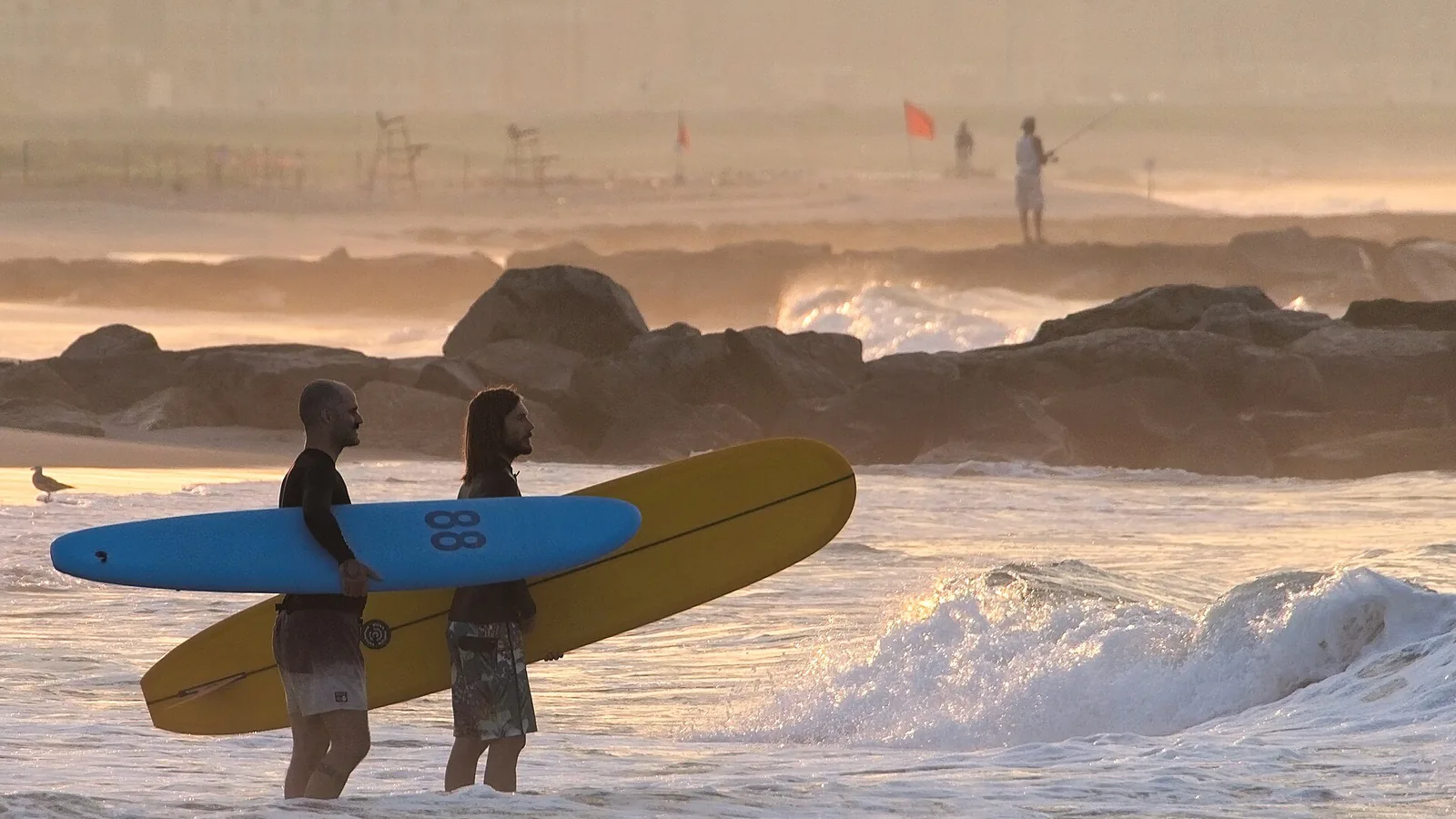
Photo: joiseyshowaa / Wikimedia Commons, CC BY-SA 2.0
The New York Bight is not a consolation prize. It is a proper east-facing swell window that happens to sit an hour from Manhattan — and it is busiest, best and coldest at exactly the time of year most people stop going to the beach.
The catch is not the waves. It is the access map. A single stretch of sand here can sit under a state park regulation, a city parks rule, a town beach ordinance and a federal compendium — four authorities with four different answers about what you are allowed to ride and when. That is what most of this page is about, because it is the part that will actually stop your session.
Some scale, from NOAA's own survey of the coastline: the south shore of Long Island runs on a bearing of 247° for 68 miles from Montauk Point to Fire Island Inlet, then 263° for another 36 miles to the western end of Coney Island. New Jersey's ocean front adds roughly another hundred miles south of Sandy Hook. We have deliberately published no drive times anywhere on this page — we could not source them from an authority, and an invented one is worse than none.
They are close enough to check all three on one forecast, and governed nothing alike.
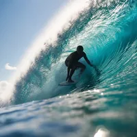
Rockaway — the only legal surfing beaches in New York City — plus Long Beach's rotating schedule next door in Nassau County.
Rockaway & Long Beach arrow_forward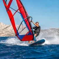
Montauk, Ditch Plains, Democrat Point and Gilgo — state park country, a $80–$125 permit, and a vehicle kit list.
The east end arrow_forward
The federal park where kiteboarding is actually allowed in writing, then a hundred miles of municipal beach-badge coast.
New Jersey arrow_forwardFive years of NOAA hourly data from buoy 44025, 30 nautical miles south of Islip, averaged by month.
Almost every surf guide to this coast says the same three things: summer is flat, September and October are the best months, and winter is big. That is correct, and you can watch it happen in the raw numbers rather than take it on trust. What follows is our own aggregation of 2021–2025 hourly records from NDBC buoy 44025. One caveat you should carry into every figure below: this is a buoy in 40 m of water, 30 NM offshore. It is not a beach reading, and nearshore water is not the same water.
| Month | Water temp | Mean wind | Mean wave height | Dominant period |
|---|---|---|---|---|
| January | 8.2 °C / 47 °F | 16.2 kt | 1.42 m | 7.0 s |
| February | 6.2 °C / 43 °F | 15.0 kt | 1.50 m | 7.4 s |
| March | 5.8 °C / 42 °F | 13.7 kt | 1.43 m | 7.2 s |
| April | 8.5 °C / 47 °F | 12.0 kt | 1.21 m | 7.2 s |
| May | 12.7 °C / 55 °F | 10.7 kt | 1.14 m | 7.4 s |
| June | 18.2 °C / 65 °F | 10.4 kt | 0.98 m | 6.8 s |
| July | 23.2 °C / 74 °F | 9.6 kt | 0.98 m | 7.2 s |
| August | 23.0 °C / 73 °F | 10.1 kt | 1.08 m | 7.6 s |
| September | 21.5 °C / 71 °F | 11.9 kt | 1.39 m | 8.7 s |
| October | 18.4 °C / 65 °F | 14.0 kt | 1.40 m | 8.5 s |
| November | 14.9 °C / 59 °F | 15.5 kt | 1.31 m | 7.0 s |
| December | 11.3 °C / 52 °F | 15.9 kt | 1.49 m | 7.3 s |
Summer really is flat. June and July share the lowest mean wave height of the year, 0.98 m, and the lightest winds. If you are coming in July for surf, come for the water temperature instead — 23 °C is the warmest this coast gets.
September and October are the groundswell window, and the data shows why. Wave height climbs back to about 1.4 m, but the telling number is the dominant period: 8.7 s and 8.5 s, the two longest-period months of the year. Moderate height with long period is the signature of swell that has travelled — distant tropical systems, rather than wind blowing on your own patch of sea. September also still holds 21.5 °C water. It is the best month here by a distance.
Winter is bigger but shorter-period. November through March runs 1.31–1.50 m at 7.0–7.4 s — locally generated wind sea from winter storms and nor'easters rather than distant groundswell. More raw energy, less order. And the water bottoms out at 5.8 °C / 42 °F in March, which is the real barrier to entry on this coast. Our wetsuit thickness guide will tell you what that means for a suit; we are not going to restate it here.
Share of hours at 15 knots or more, and where the wind comes from when it blows. Same buoy, same five years.
| Month | Hours ≥ 15 kt | Prevailing direction when windy |
|---|---|---|
| January | 63.4% | NW, WNW, W |
| February | 51.9% | NW, WNW, NE |
| March | 39.3% | WNW, NW, S |
| April | 31.4% | WNW, SSW, NW |
| May | 17.9% | NE, ENE, E |
| June | 19.2% | SSW, ENE, SW |
| July | 11.3% | SSW, S, SW |
| August | 18.5% | ENE, NE, E |
| September | 30.1% | ENE, NE, NNE |
| October | 42.9% | NE, N, W |
| November | 54.5% | WNW, W, NW |
| December | 54.8% | W, NW, WNW |
The awkward fact in that table, and it is worth seeing before you book: the windiest months are the ones whose wind comes from the wrong side of the land. November to February all run above 50% of hours at 15 knots or more, and all of them are dominated by NW, W and WNW — which, on a coast whose south shore faces roughly south-southeast, is offshore. Plenty of wind, blowing away from the beach.
The reliable onshore wind is the SSW sea breeze in June and July — at the exact moment the table shows the fewest windy hours of the year — and the ENE and NE flow in September, which is also when the swell is best. That September column is doing a lot of work on this coast. Read this as our interpretation of the wind roses and the coastline's orientation rather than as a rule: the raw direction counts are measured, the read on what they mean for a given beach is ours.
The two most accessible surf beaches in the region, and the two with the most specific rules.
NYC Parks describes Rockaway as having "the city's only legal surfing beaches" — that is the City's own wording, and it is the reason this beach is as busy as it is. The designated surf blocks are Beach 66 to Beach 70 Street, Beach 87 to Beach 92 Street, and Beach 110 to Beach 111 Street. Everywhere else on the peninsula is a swimming beach or a fishing beach, not a surf break you are allowed to use.
Two things about the surf beaches specifically, both from the City's posted rules. They are open year round, dawn until dusk — unlike the swimming beaches, which run Memorial Day weekend to the Sunday after Labor Day. And there are no lifeguards on the surf beaches at any time; the City's own sheet says "surf at your own risk". There is an emergency call box at Beach 90th Street. The general beach rules still apply on top, and they prohibit snorkels, fins, rafts and other flotation devices, alcohol, open fires and unleashed dogs.
Check the block numbers before you travel. NYC Parks lists Beach 110–111 as a surf beach and, on the same page, lists Beach 111–116 as closed for swimming due to construction. Those two designations overlap at Beach 111. Surf beaches are non-swimming by definition so the two may well be compatible, but the City does not say so anywhere we could find — and this page is a snapshot, while theirs is live. Read the current NYC Parks Rockaway page on the day.
Seven miles east, and a completely different regime. Azores and Lincoln Boulevard Beach is a permanent surfing beach. Everywhere else, surfing moves — the City publishes a rotating schedule, seven days a week, with separate Westholme and West End columns, and it is explicit that the allocation is "subject to change at ANY TIME upon the discretion of the Chief of Lifeguards". Check it the morning you go, not the week before.
The City's rules that catch visitors out: surfing only happens while lifeguards are on duty; leashes are required; the rotating beaches close to surfing at noon on weekends and holidays; foil boards are prohibited at all times; bodyboards and surfboards may not share a bathing area; and there is no fishing on a surfing beach.
Beach passes for 2026 are $85 for a resident individual and $170 for a non-resident individual, or $12 and $16 for a resident and non-resident day pass respectively. Family, senior, child, access and military/veteran rates all sit below those.
Long Beach also formally zones water for instruction — surf schools operate seven days a week between Maple and Pacific Boulevards and between Long Beach Boulevard and Riverside Boulevard. A town setting aside dedicated water for commercial surf teaching is a fair sign of how established the scene is here.
Montauk, Ditch Plains, Democrat Point and Gilgo — where a piece of paper and a shovel get you to the sand.
Several of the best-known breaks out here are reached by driving onto the beach, and New York State Parks sells a specific permit for it: the Surfing/Windsurfing 4-Wheel Drive Access Permit, $80 for a New York State resident and $125 for a non-resident. It expires on 31 December whatever date you buy it, and you need a valid vehicle registration, a valid driver's licence and to be over 18.
Be clear about what it is: a vehicle access permit for daylight surfing and windsurfing, not a licence to surf. The permit holder and every passenger over 12 must have surfing equipment with them and show it on request — and the guide states outright that "boogie boards do not qualify as surfing equipment". Your vehicle has to carry a shovel, rope or tow chain, a portable toilet, a jack and jack board, a full-size spare and a tyre gauge, with tyres no wider than 35x12.5 aired down to half their maximum pressure.
| Area | Access window |
|---|---|
| Hither Hills and Napeague | Year round |
| Montauk Point | 1 January – 31 March only |
| Robert Moses — Democrat Point | All year, sunrise to sunset, weather permitting. Between the Saturday of Memorial Day weekend and Labor Day you must enter before 7am or after 5pm |
| Robert Moses — Fields 3 & 4 | Parking lot access 15 September – 31 December |
| Gilgo | All year, 24-hour access |
Gilgo is genuinely ambiguous and we are not going to pretend otherwise. The State Parks permit guide grants 24-hour 4WD access at "Gilgo" as a State Park. NOAA's Coast Pilot states that "Cedar Beach and Gilgo Beach … are maintained and operated by the County and Township authorities and are not part of the Long Island State Park System". The Town of Babylon separately sells a beach permit covering Gilgo Beach. These are almost certainly describing adjacent parcels under different authorities — but no source we could find draws the boundary, so we will not tell you which permit covers a given point of sand. Ask at the Robert Moses park office before you rely on either.
Ditch Plains is the best-known break on the east end and sits under the Town of East Hampton rather than the State. The town's published guidance is that parking is for East Hampton residents, that vehicular beach access needs a town permit, and that non-residents obtain permits through the Chamber of Commerce rather than the Clerk's office. Lifeguards cover weekends from Memorial Day weekend to mid-June, then daily to Labor Day weekend, then two more weekends; swimming is 9am–5pm in designated areas only. We were not able to fetch the town's own pages directly to verify those details at source, so treat them as a starting point and confirm with the Town. Note separately that the State permit only reaches Montauk Point between 1 January and 31 March.
This is the single most misreported thing about the region, so here is the actual instrument in each case.
You will read in places that "the 4WD permit bans kite-surfing". That is true but much narrower than it sounds — it is a condition of that one permit, over the beaches that permit covers, in a clause that also prohibits fishing, barbecues, pets and drones.
The rule that actually governs the state's parks is a different instrument: 9 NYCRR § 377.1. It defines "boat or watercraft" to expressly include a "kiteboard", alongside sailboards, paddleboards and inflatables. It then bars any watercraft from operating within a bathing or surfing area — and for the ninth park region, which is Long Island, it deems that area to extend 1,000 feet from any bathing beach or surfing area on the Atlantic, Long Island Sound and the bays.
The regulation then grants an exception — but only to paddleboards, windsurfing boards and sailboards, which may be used in areas specifically designated for them, with a personal flotation device. Kiteboards are pointedly not in that list. When the state made that rule in 2015 it said why, on the record: "OPRHP continues to prohibit activities that may promote conflicts between uses, such as kiteboarding." The rule took effect on 23 March 2016.
Gateway is the federal park that covers Sandy Hook in New Jersey and Jacob Riis, Fort Tilden and Breezy Point in New York — including water inside New York City. Its 2026 Superintendent's Compendium is unambiguous: "Kite Boarding is allowed; except within 650 feet of posted shorebird nesting areas or lifeguarded swimming beaches." The stated reason is disturbance to nesting shorebirds and danger to swimmers.
That makes Gateway the most permissive jurisdiction in the region for kiteboarding by a wide margin — and it is why Plumb Beach in Brooklyn matters. The compendium lists the park's authorised hand-launch sites, and launching a vessel anywhere else in the park is prohibited. They are: Plumb Beach; Floyd Bennett Field's Mill Basin inlet and seaplane ramp; Riis Landing; Rockaway Point Cove; Rockaway Point Yacht Club; Canarsie Pier; Jamaica Bay North Channel; and, on the New Jersey side, Sandy Hook Bayside Area C and Horseshoe Cove. Permits or fees may apply.
Kite flying and kiteboarding are separate rules at Gateway, and the flying one is stricter. Flying a kite is prohibited from 15 March to 15 September at Fort Tilden Beach, West Beach, the ocean and bay beaches of Breezy Point Tip, and Sandy Hook's ocean-side beaches — plus within 650 ft of shorebird nesting areas, in parking areas, within 1,000 ft of the Floyd Bennett model airplane field, and on lifeguarded beaches while guards are on duty. Do not read the kiteboarding permission as covering a kite on the sand.
We looked for a municipal kiteboarding rule at Manasquan, Belmar, Long Branch, Seaside Heights and Cape May, and for one at Island Beach State Park, and found none. That is an honest gap rather than a green light: New Jersey's municipal codes are hosted on a platform that blocked us, so absence here means unverified, not allowed. The same is true of Long Beach, New York, which publishes detailed surfing, bodyboarding and foil-board rules and says nothing at all about kites. Ask the town before you rig.
A federal park with written rules, then a hundred miles of towns that each set their own.
Because Sandy Hook is federal, its surfing rules are written down in one place and are the clearest in the region. Surfing and stand-up paddleboarding are allowed at Oceanside Beach B and in the unprotected part of Oceanside Beach C. At the lifeguarded part of Beach C they are allowed only before 10am and after 6pm — surfboards and SUPs are prohibited at lifeguarded beaches during guarded hours, 10am to 6pm. Surfing is prohibited outright on any beach with an enclosure protecting shorebirds.
Worth knowing before you arrive: flotation devices are prohibited at Gunnison Beach and North Beach because of strong currents; glass is prohibited on all park beaches; alcohol is prohibited across the whole of Sandy Hook; drones and personal watercraft are prohibited. Part of Area G at South Gunnison is a signed clothing-optional area.
South of Sandy Hook, every town runs its own beach. We could not read the underlying ordinances — New Jersey's municipal code platform returns an error to automated access — so what follows is drawn from towns' own public pages where they were reachable, and flagged where it was not.
Manasquan states on its own beach FAQ that the surfing beaches run from Inlet Beach to Whiting II Beach, at the discretion of the lifeguards. It also publishes the most useful flag key on the coast, and it is not the one you may be used to: green = safe, yellow = caution, red = water entry prohibited, blue = areas for floatables and rafts, white = swimming only. 2026 badges are $90 adult, $45 junior, $35 senior, free for active US military and immediate family and for veterans.
Long Branch publishes 2026 badges at $6 weekday, $9 weekend and holiday, $70 annual, free for under-14s, over-62s and disabled visitors, across 22 beach entrances — and notes specifically that this does not cover Seven Presidents, which is a Monmouth County park north of Seaview Avenue. Its designated surfing beach is reported to be Hudson Avenue, marked by quartered black-and-white flags while guards are on duty; we could not confirm that at source.
Belmar is reported to designate 17th and 18th Avenues as surfing beaches, with swimming not permitted there and boards limited to 10 feet; again, ordinance text unverified. Its 2026 badges are listed at $12 daily, $80 seasonal, $32 senior, required 9:00–17:00 on weekdays and 9:00–18:00 Friday to Sunday and holidays. Island Beach State Park allows surfing south of the swimming beaches and windsurfing in marked areas at the extreme southern end of the designated swimming area, per secondary sources — the park's own page gave us nothing readable on two attempts.
The parts of this coast that actually hurt people, with the numbers behind them.
The National Weather Service publishes an annual surf-zone fatality table. For these two states it records five deaths in New York and none in New Jersey in 2024, two in New York and three in New Jersey in 2025, and a further two and four in the preliminary 2026 table — sixteen across three seasons. The dataset counts all surf-zone fatalities across five categories, not rip currents alone, so do not read it as a rip-current count.
The 2026 entries are worth reading individually, because four of the six are on this page's own coast: Rockaway Beach (17M, 9 August, rip current), Seaside Park and Ship Bottom in New Jersey (23M and 28M, both 5 June, both rip current), and Wildwood (14M, 1 June, cause not known), plus Ocean City NJ (20M, 18 May). The sixth, at Sandy Island Beach State Park, is on Lake Ontario rather than the Atlantic — NWS counts fresh-water surf zones in the same table, so a state total is not the same as a coast total.
Over a longer run the pattern is sharper, and it should change when you are careful. Across 2016–2025 New Jersey recorded 46 surf-zone deaths, with rip currents blamed for about three quarters of them — and 19 of the 46, roughly 41%, happened in September. By county: Ocean 17, Monmouth 13, Cape May 10, Atlantic 6. That figure comes from a news analysis of NWS data rather than from NWS directly, so treat the precise split as indicative.
This is the one piece of this page we would most want you to carry. September is the best surf month on this coast — longest period, best swell, water still at 21 °C — and in New Jersey it is also the deadliest month in the surf zone by a wide margin. Nationally the NWS says most US surf-zone deaths fall in June and July; New Jersey's own record points at September. Both are true of different geographies, and the September concentration is the one that overlaps with the reason you would come.
The Coast Pilot is written for mariners, but its warnings are the best-sourced spot hazards on this coast. Moriches Inlet: "considered unsafe for mariners to navigate this inlet at any time. Buoys are not maintained in this inlet." Shinnecock and Moriches: use "not advisable without local knowledge". Jones Inlet: should not be attempted without local knowledge, because channel and depths are constantly changing.
On the New Jersey side, Barnegat Inlet is the one to respect: subject to continual severe shoaling, with a current of about 2.5 knots and up to 7 knots reported — and the sentence that matters most to anyone on a board, "Breakers make across the inlet with an ebb tide and an easterly wind." That is wind against tide, in the exact configuration an easterly swell day produces. Manasquan Inlet runs about 1.8 knots and NOAA advises caution when wind and tide oppose each other.
Both states impose a mandatory wear rule between 1 November and 1 May, which is to say across most of the season this coast is actually good. They are not the same rule and are often reported as if they were:
The federal baseline underneath all of this is on our United States guide: a board counts as a vessel only when used beyond the narrow limits of a swimming, surfing or bathing area, and once it does, 33 CFR 175.15 applies. Emergencies anywhere on this coast: 911, or the Coast Guard on VHF 16.
Two things people ask about this coast specifically, with what the agencies actually publish.
New York City runs a combined system for stormwater and sewage. Its health department puts the problem plainly: in heavy rain the system can reach capacity, and the excess — a mix of stormwater and untreated or partially treated sewage and industrial wastewater — bypasses treatment. That is combined sewer overflow, and the City publishes rainfall thresholds that trigger swimming advisories at named beaches, ranging from 0.3 inches in 24 hours at the most sensitive sites to 2.5 inches at the least.
Rockaway does not appear in that table at all. The rainfall-advisory regime is overwhelmingly a bay, sound and estuary problem — Jamaica Bay, Long Island Sound, the Raritan Bay shoreline. We are not going to draw the conclusion for you that ocean surfing is therefore unaffected by rain; what we can say is that the City publishes no rainfall advisory threshold for Rockaway, and that the live NYC beach water quality page is the thing to check after a storm.
New Jersey samples about 195 ocean and 25 bay stations weekly from mid-May to mid-September. In 2025, 3,346 ocean samples produced 11 advisories and zero closures, clustered after overnight rainstorms. On that record the Jersey ocean front is in good shape; the advisories that do appear follow rain, which is the pattern to plan around.
New York State's published protocol, as of May 2026: when a shark is sighted or an interaction reported at a state beach, swimming is immediately suspended and all swimmers are cleared from the water, and may not resume sooner than one hour after the last confirmed sighting. Lifeguards, Park Police and staff monitor, including with a drone carrying thermal imaging and the ability to drop flotation. A coordinating group spanning more than 200 people across municipalities and agencies from Queens eastward shares sightings so closures line up across jurisdictions. One thing that protocol does not address, and we could not find addressed anywhere: how it applies to surfers outside lifeguarded hours. It speaks only about swimming at guarded state beaches.
What people ask most before surfing or kiting the New York Bight.
No. Several sources mention one, usually as a cheap after-Labor-Day option. The phrase appears nowhere in either the 2025 or the 2026 official Long Island Permit Guide, and the only $25 item in the official guide is a night sport fishing permit. The permit that exists is the Surfing/Windsurfing 4-Wheel Drive Access Permit at $80 resident and $125 non-resident.
In Gateway National Recreation Area's waters, yes — the federal compendium allows it except within 650 feet of posted shorebird nesting areas or lifeguarded swimming beaches, and Plumb Beach in Brooklyn is one of the park's authorised hand-launch sites. In New York State Parks, no: their regulation classes a kiteboard as a watercraft, keeps watercraft 1,000 feet clear of any bathing or surfing area on Long Island, and excludes kiteboards from the exception it grants paddleboards and windsurf boards. Those are two different authorities governing beaches that are sometimes a few miles apart.
September, on the measured data and by a clear margin: the longest dominant wave period of the year at 8.7 seconds, wave height back up to about 1.4 m, and water still at 21.5 °C. October is close behind. The trade-off is that September is also the month New Jersey records about 41% of its surf-zone deaths, so it is the month to be most careful, not least.
July and August water runs about 23 °C / 73 °F at the offshore buoy, which is the warmest this coast gets — many people surf those two months in shorts or a top. March is the other end at 5.8 °C / 42 °F. Our wetsuit thickness guide converts a water temperature into a suit; note the buoy sits 30 NM offshore in 40 m of water, so treat it as a guide to the trend rather than a beach reading.
Rockaway only. NYC Parks calls them "the city's only legal surfing beaches", and they are Beach 66–70, Beach 87–92 and Beach 110–111 Street. They are open year round dawn to dusk and have no lifeguards at any time. Check the City's live page for the current block numbers before travelling — a construction closure currently overlaps the Beach 110–111 designation.
It is plentiful in winter and mostly pointing the wrong way. November to February all run above 50% of hours at 15 knots or more, but dominated by NW, W and WNW, which is offshore on the south-facing shore. The workable onshore wind is the SSW sea breeze of June and July — the least windy months of the year — and the NE and ENE flow in September. That is our read of the direction data rather than a rule for any given beach.
If what you are on counts as a vessel, yes, in both states, between 1 November and 1 May. New Jersey's rule covers craft under 26 feet and names stand-up paddleboards explicitly; New York's covers craft under 21 feet and names rowboats, canoes and kayaks but not SUPs. Whether a board is a "vessel" at all turns on the federal test — broadly, whether you are outside a swimming, surfing or bathing area. Inside New York State Parks the requirement to wear one while paddleboarding or windsurfing applies year round.
Both answers are in print and we cannot reconcile them. New York State Parks' permit guide grants 24-hour 4WD access at "Gilgo" as a state park; NOAA's Coast Pilot says Gilgo Beach is run by county and township authorities and is not part of the state park system; the Town of Babylon sells a permit covering Gilgo Beach. They are very likely adjacent parcels, but nothing we found draws the line, so confirm with the Robert Moses park office rather than buying on an assumption.