
📍 Virginia, United States
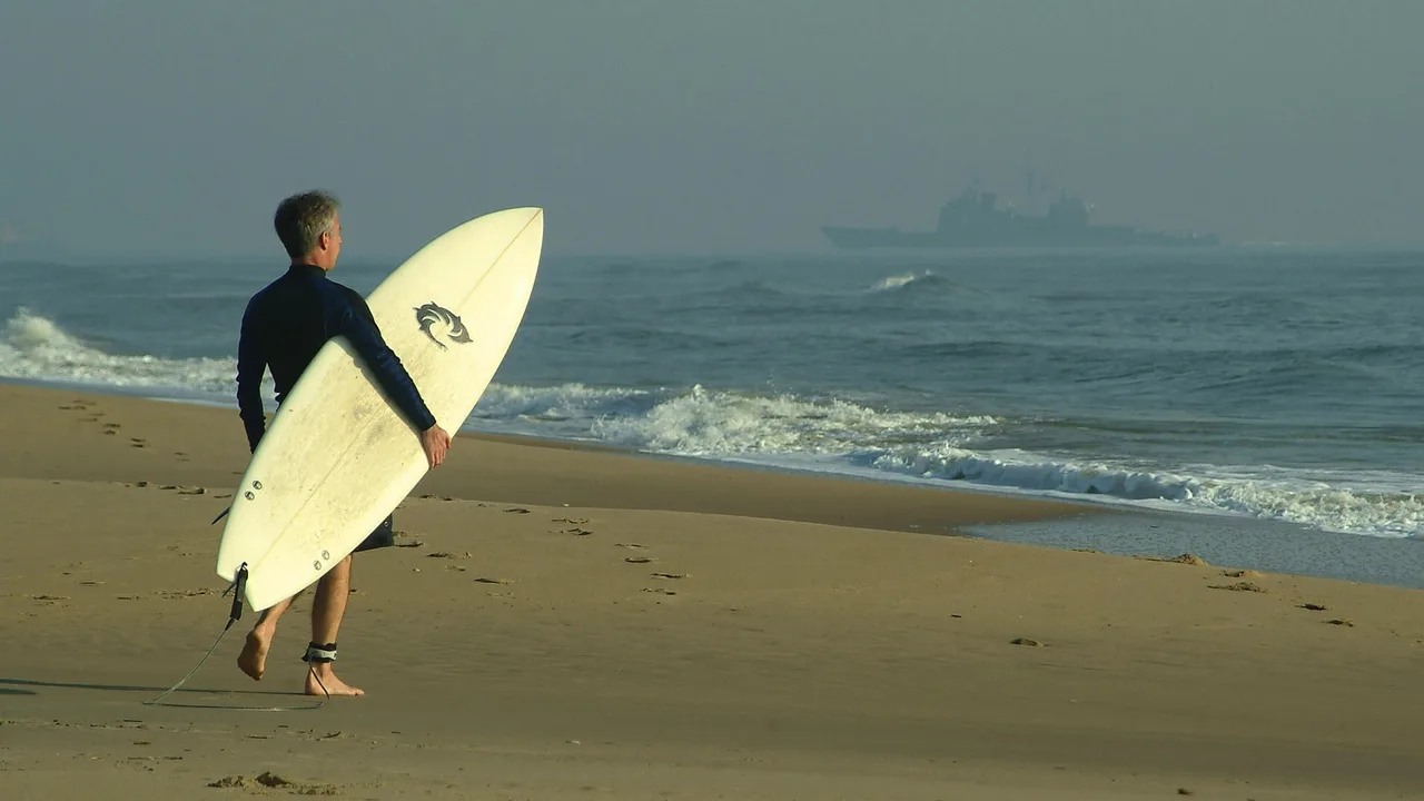
Photo: Chief Photographer's Mate Johnny Bivera / U.S. Navy, public domain
Virginia Beach's own municipal ordinance, not a generic East Coast rule borrowed from a neighbour.
Search demand for surfing at Virginia Beach runs at roughly 17.6 times the volume of kiteboarding or kitesurfing terms for the same stretch of coast — a real, measured gap, if a narrower one than South Carolina's. Virginia's search demand is also overwhelmingly a city-level phenomenon rather than a statewide one: "virginia beach surfing" measures 880 searches a month, while "surfing virginia" (the whole state) manages only 30. This page is scoped and titled around Virginia Beach for that reason, even though it sits at the state level in this guide's structure.
Virginia Beach's oceanfront and Sandbridge, on the Atlantic, are where the surfing happens and where the city's own § 6-116 ordinance sets the rules. First Landing State Park, a few miles north on the Chesapeake Bay side, is a genuinely different kind of place — flat, sheltered water that the state's own park page describes for swimming, not surfing. Know which coast you're on before you paddle out.
A citywide surf-zone ordinance with named hours, named beaches and a hard-coded 30-foot "shorebreak" definition, read from the city's own code, not a tourism summary.
Virginia Beach's ordinance arrow_forward
A real, official DCR "swim at your own risk" beach on the flat Chesapeake Bay side — genuinely a different kind of spot from the oceanfront, not an ocean surf break.
First Landing in detail arrow_forward
Virginia's own regulation excludes surfboards from its definition of "vessel" entirely, and separately exempts sailboards from carrying a PFD at all — read the regulation, not a summary.
The PFD law arrow_forward"Cape Henry, VA (147)," at the mouth of the Chesapeake Bay — real wave and water-temperature data, but no working wind sensor in the archived record.
NDBC 44099 sits at 36.915°N, 75.722°W, in 15 meters of water just offshore of Cape Henry, at the entrance to the Chesapeake Bay. We pulled and aggregated NOAA's own hourly standard-meteorological archive for this buoy across six full years (2019-2024) directly from ndbc.noaa.gov, the same method used for our South Carolina page. Unlike that page's buoy, though, 44099's wind (WDIR/WSPD) and air-temperature fields read as NDBC's own missing-value codes in every single one of the six years we pulled — even though the station's current page lists wind among its design sensors. We're not going to invent a wind percentage this buoy didn't actually give us: the table below shows only what 44099 measured cleanly across those six years — wave height, dominant period and water temperature.
| Month | Water temp | Wave height | Dominant period |
|---|---|---|---|
| January | 8.6 °C / 47.4 °F | 1.08 m | 7.8 s |
| February | 7.1 °C / 44.7 °F | 1.10 m | 7.7 s |
| March | 8.8 °C / 47.9 °F | 1.11 m | 7.8 s |
| April | 12.4 °C / 54.2 °F | 1.02 m | 8.0 s |
| May | 17.0 °C / 62.6 °F | 1.01 m | 7.6 s |
| June | 22.0 °C / 71.7 °F | 0.83 m | 7.7 s |
| July | 25.0 °C / 77.0 °F | 0.77 m | 8.1 s |
| August | 24.7 °C / 76.5 °F | 0.79 m | 8.4 s |
| September | 24.0 °C / 75.3 °F | 1.17 m | 9.3 s |
| October | 20.4 °C / 68.7 °F | 1.13 m | 8.8 s |
| November | 16.0 °C / 60.8 °F | 1.11 m | 7.7 s |
| December | 11.2 °C / 52.2 °F | 1.05 m | 8.0 s |
The coldest water of the year lands in February, not January — a real thermal-lag effect our own six-year measurement shows plainly (7.1 °C / 44.7 °F in February versus 8.6 °C / 47.4 °F in January), and worth knowing if you're timing a winter session. Dominant period holds at a genuine 7.6-9.3 seconds every month of the year — real groundswell, not local windsea — and peaks sharply in September at 9.3 seconds alongside the year's biggest average wave height (1.17 m), consistent with NOAA's Atlantic hurricane season (June 1-November 30, historically peaking around September 10) sending long-period swell up the mid-Atlantic coast. Water temperature swings from a February low of 7.1 °C / 44.7 °F to a July peak of 25.0 °C / 77.0 °F — genuinely cold in winter, unlike South Carolina or Georgia further down this coast. Our wetsuit thickness guide converts that water temperature into a suit recommendation. Remember this is a 15m-deep offshore reading at the Bay's mouth, not a Virginia Beach oceanfront-specific measurement — treat it as a regional proxy for season and swell period, not a beach-side number.
Virginia Beach City Code, Chapter 6 "Beaches, Boats and Waterways," Article V "Boating, Skiing and Surfing" — read directly from the city's own code PDF.
Virginia Beach's surfing rules don't create one simple swim-zone map; they restrict surfboard use, by name, across most of the developed oceanfront and Sandbridge during specific hours in season, with a short list of always-open exceptions. Verbatim, from § 6-116(b): during daytime hours on Fridays, weekends and holidays from Memorial Day Weekend to Labor Day Weekend, "it shall be unlawful for any person to use a surfboard in the waters of the Atlantic Ocean" in four named stretches: from Little Island Park's north boundary to the Sandbridge lifeguard-patrolled swim area's south boundary; from that swim area's north boundary to the Dam Neck Fleet Combat Training Center's south boundary; from 42nd Street to 56th Street; and from 58th Street to the southern boundary of Fort Story. Subsection (c) adds a second, differently-timed restriction (10am-4pm weekdays, 10am-6pm weekends and holidays) covering the Sandbridge swim area itself, Rudee Inlet's north jetty to 42nd Street, and the short stretch from 56th to 58th Street. Subsection (d) adds a third, 11am-4pm-every-day restriction from Rudee Inlet's south boundary to a point 200 feet north of Camp Pendleton.
Against all of that, § 6-116(e) lists the areas where surfing is always permitted, notwithstanding those restrictions: from Little Island Park's south boundary to the North Carolina state line (subject to any federal restrictions where the beach is federally owned); at Little Island Park itself; from Rudee Inlet's south jetty to a point 800 feet south of it; from Rudee Inlet's north jetty to a point 500 feet north of it; and a short designated strip from 300 feet north of 3rd Street to 100 feet north of 5th Street — closely matching, and now confirmed against the actual code text, what a tourism site had described only approximately as "designated surfing areas... between 4th and 5th Street."
The code defines its own 30-foot buffer, and it's not the pier buffer a tourism site implied. § 6-116(a)(4) defines "shorebreak" as "the area between the shoreline of the Atlantic Ocean and a continuous line running thirty (30) feet east of the shoreline." § 6-116(f)(4) then bans using a surfboard within that shorebreak, in season, unless you're paddling or wading beside the board to enter or exit the water, or you're in a designated surfing area. That is a real 30-foot rule, but it governs how you carry your board through the shallows, not a no-surfing buffer around a pier or jetty.
Three rules in § 6-116(f) apply citywide, in every zone, all year: "No person shall use a surfboard from one-half hour after sunset to one-half hour before sunrise"; "No person shall use a surfboard unless a leash or tether joins the surfer to the surfboard"; and "No person shall use a surfboard in the area between the south and north jetties of Rudee Inlet" — the inlet mouth itself is off-limits to surfboards at any time. A separate section, § 6-22, sets a 200-foot no-entry buffer around any public fishing pier, citywide: "It shall be unlawful for any person to be in or on the water within two hundred (200) feet of any public fishing pier."
Kiteboarding, kitesurfing and windsurfing are not named anywhere in this chapter. A full-text search of the city's own code PDF for "kite," "windsurf" and "sailboard" turns up nothing relevant — § 6-116 is written entirely around the word "surfboard." That silence isn't a ban and isn't a permission; the rule is simply written for surfing and doesn't address those other sports one way or the other.
A few related sections matter if you're being towed or riding a jet ski rather than paddling out. § 6-117 requires an observer or rear-view mirror aboard any boat towing a skier or surfboarder, and requires "each skier or surfboarder" to wear "a U.S. Coast Guard approved personal flotation device" while being towed. § 6-118 separately bans towed water-skiing or surfboarding between half an hour after sunset and half an hour before sunrise. § 6-120.1 governs personal watercraft (jet skis): every rider must wear a Coast Guard-approved wearable PFD, no one under 14 may operate one at all, and those 14 to 35 need a completed boating-safety course; a personal watercraft must also stay at slow, steerage-only speed within 50 feet of any pier, dock, shore, other vessel, swim-area boundary or person in the water.
One more section is relevant to First Landing State Park below, though it sits in Article I rather than Article V: § 6-16.1 creates a seasonal (May 1-October 15, 10am to sunset) motorboat-exclusion zone extending 100 yards seaward of BOTH the Chesapeake Bay beaches (from Little Creek Naval Amphibious Base to Fort Story — the stretch First Landing sits within) and the Atlantic beaches (from Back Bay National Wildlife Refuge to Fort Story), reserving that water for swimming, wading, crabbing and fishing rather than motorized boat traffic.
Virginia Department of Conservation and Recreation's own First Landing park page, read directly.
First Landing sits a few miles north of the Virginia Beach oceanfront, but on the Chesapeake Bay side rather than the open Atlantic — a genuinely different coast, not a quieter version of the same one. DCR's own park page is direct about it: "Swim at your own risk in Chesapeake Bay; no lifeguards," with a separate warning that "swimming at the Narrows is not advised because currents there are strong" and that there are "no designated swimming areas at the Narrows or boat launch." The park offers 1.5 miles of sandy Bay beach frontage.
Nothing in that page, in DCR's statewide swimming-rules page for Virginia's state parks, or in the State Parks chapter of the Virginia Administrative Code (4VAC5-30) names surfing, kiteboarding, kitesurfing or windsurfing at First Landing — the park is governed only by general swimming and boating language. We searched specifically and found no primary source calling First Landing a surf spot, and measured search demand for it agrees: "first landing state park surfing" comes back at a flat, verified 0 searches a month. First Landing sits inside the § 6-16.1 motorboat-exclusion zone described above, which independently corroborates its character as a sheltered, swimming-oriented bay beach rather than an ocean break — genuinely useful for flat-water paddling, kayaking and SUP, just not for surfing.
We could not confirm a documented kite or windsurf spot at the Chesapeake Bay Bridge-Tunnel either. A dedicated search for a windsurf or kiteboard launch near the CBBT, or elsewhere on the Bay side of Virginia Beach, found no Virginia Administrative Code section, DCR document or Corps of Engineers material naming one — and "chesapeake bay bridge tunnel windsurfing" measures a flat 0 searches a month. If such a spot exists in local practice, it isn't documented anywhere we could verify, so we're reporting that absence rather than guessing at a location.
Code of Virginia § 29.1-735 and Virginia Administrative Code 4VAC15-430-20, -30 and -40 — read directly at law.lis.virginia.gov.
Virginia's core PFD rule, at 4VAC15-430-30, is a carriage rule for ordinary recreational vessels, not a universal wear mandate: "at least one wearable PFD is on board for each person," plus one throwable PFD if the vessel is 16 feet or longer. The one activity with a genuine wear mandate is personal watercraft — jet skis and similar craft — where the regulation states plainly: "it shall be unlawful to operate a personal watercraft unless each person riding on the personal watercraft or being towed by it is wearing a wearable PFD that is approved for such activity."
Surfboards aren't excluded from the PFD rule — they're excluded from the definition of "vessel" itself. 4VAC15-430-20 defines "vessel" as "every description of watercraft... used or capable of being used as a means of transportation on water, but does not include surfboards, tubes, swimming rafts, inflatable toys, and similar devices routinely used as water toys or swimming aids." A surfboard is written out of scope entirely, the same shape as South Carolina's statute on our South Carolina guide.
A windsurfer is handled differently, and it's worth knowing the distinction: a "sailboard" IS a vessel under Virginia's general definition, but 4VAC15-430-40(B) separately exempts it from the PFD-carriage requirement by name: "The following vessels are... not required to carry any PFD: ... 2. Sailboards." The same exemption section excuses racing shells, rowing sculls, and racing canoes/kayaks while actually racing, and drops the additional-throwable-PFD requirement for personal watercraft and for nonmotorized canoes and kayaks 16 feet and over.
Kiteboards and stand-up paddleboards aren't named in either the exclusion or the exemption list — a genuine gap in the regulation, not one we're filling in by analogy to surfboards or sailboards. No Virginia-specific age-based PFD-wear mandate was found in this regulation either; DWR's own site notes a federal under-13 rule for federal waters, which is the federal baseline covered on our United States guide, not a state-specific one. In a sea emergency anywhere on this coast: 911, or the Coast Guard on VHF 16.
Not everywhere, and not at all hours in season. § 6-116 restricts surfboard use across most of the developed oceanfront and Sandbridge during specific daytime windows from Memorial Day Weekend to Labor Day Weekend, but always allows it at Little Island Park, a stretch either side of the Rudee Inlet jetties, a short zone near 3rd-5th Streets, and everywhere south of Little Island Park to the North Carolina line. A leash is mandatory citywide, year-round, and surfing is banned between the Rudee Inlet jetties at any time.
No — it's a Chesapeake Bay beach, not an ocean beach, and the state's own park page describes it for swimming ("swim at your own risk in Chesapeake Bay; no lifeguards"), not surfing. Measured search demand for surfing there is a flat zero. It's a genuinely different, sheltered coast from the Virginia Beach oceanfront a few miles south, better suited to kayaking, SUP or a calm swim.
Not to surf: Virginia's regulation excludes surfboards from its definition of "vessel" altogether, so the PFD rules don't reach surfing at all. A windsurfer (sailboard) is technically a vessel but is separately exempted from carrying any PFD. Kiteboards and SUPs aren't named either way, which is a real gap in the regulation, not a confirmed exemption.
Surfing, measurably: search demand for surfing terms at Virginia Beach runs at roughly 17.6 times the volume of kiteboarding or kitesurfing terms for the same coast. Virginia Beach's own city ordinance is written entirely around the word "surfboard" and doesn't name kiteboarding or windsurfing at all.