

📍 Massachusetts, United States
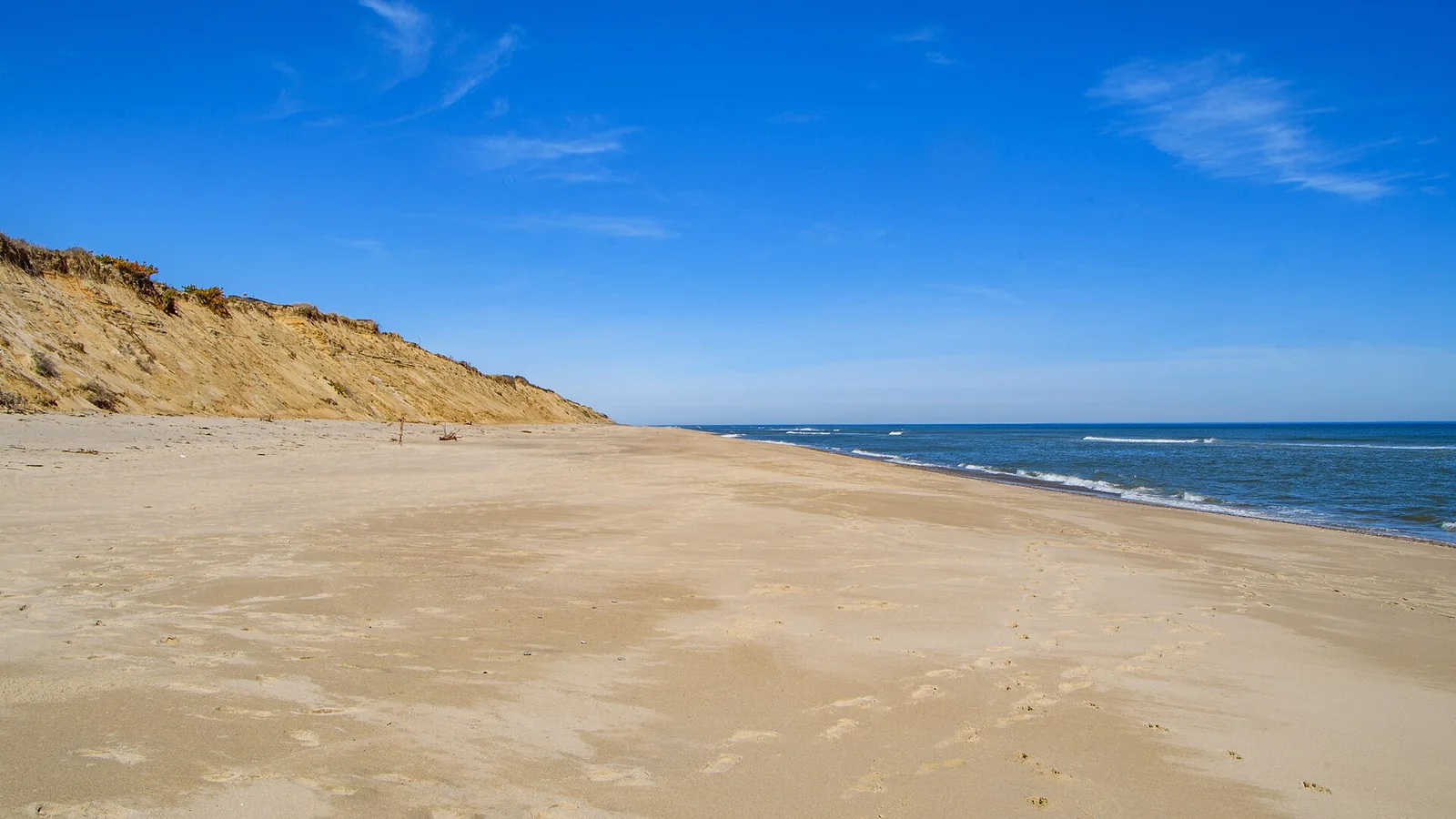
Photo: Dennis Weeks / Wikimedia Commons, CC BY 4.0 — Marconi Beach in March. A scenic shot of the outer Cape, not a surfing action photo: no suitably licensed photograph of anyone riding in Massachusetts could be found.
The outer Cape faces the open Atlantic. Cape Cod Bay is sheltered behind it. Nantucket Sound is shallow, warm and windy — and gets no swell at all.
Massachusetts is the most serious surf coast north of New Jersey, and the one where the most rules apply. Most of the outer Cape sits inside Cape Cod National Seashore, a federal park whose Superintendent's Compendium is refreshingly specific about what you may ride and where. Off park land you are into state beach regulations and then town ordinances, which are neither consistent with each other nor with the federal rules.
And it is the one coast in this locale where a safety question comes before the equipment question. The white shark population on the outer Cape is real, documented, and managed by agencies that publish specific guidance for people on boards. That guidance is further down this page, quoted rather than paraphrased.
The buoy data settles most of this argument before anyone has to have it.

Coast Guard, Nauset Light, Marconi, Head of the Meadow, Race Point — open Atlantic, and the federal rules that come with it.
The Seashore arrow_forward
The best summer wind in New England by a factor of five — and a dominant wave period that never reaches four seconds.
The wind arrow_forward
Gloucester and the state-run beaches, where the rules come from DCR and the town rather than the park service.
North of Boston arrow_forwardFive years of NOAA hourly data (2021–2025) from two buoys that describe two different coasts.
What follows is our own aggregation of raw NOAA observations, not a surf guide's summary. NDBC 44013 sits 16 NM east of Boston in 64.6 m of water; NDBC 44020 sits in Nantucket Sound in 16.5 m. Two caveats you should carry into every figure: these are offshore buoys, not beach readings, and their anemometers are mounted at 3.2–4.1 m rather than the 10 m standard — so the wind speeds below read lower than the numbers a forecast site will quote you.
| Month | Water, Mass. Bay | Water, Nantucket Sd | Wave ht / period, Mass. Bay | Wave ht / period, Nantucket Sd |
|---|---|---|---|---|
| January | 6.4 °C / 44 °F | 4.1 °C / 39 °F | 1.22 m / 6.8 s | 0.56 m / 3.9 s |
| February | 4.7 °C / 41 °F | 2.7 °C / 37 °F | 1.14 m / 7.0 s | 0.53 m / 3.9 s |
| March | 4.8 °C / 41 °F | 4.5 °C / 40 °F | 1.14 m / 7.0 s | 0.57 m / 3.9 s |
| April | 6.7 °C / 44 °F | 8.3 °C / 47 °F | 0.93 m / 7.2 s | 0.50 m / 3.8 s |
| May | 11.0 °C / 52 °F | 12.8 °C / 55 °F | 0.82 m / 7.1 s | 0.46 m / 3.7 s |
| June | 15.9 °C / 61 °F | 18.2 °C / 65 °F | 0.57 m / 7.2 s | 0.37 m / 3.5 s |
| July | 18.8 °C / 66 °F | 23.2 °C / 74 °F | 0.49 m / 7.5 s | 0.35 m / 3.3 s |
| August | 19.8 °C / 68 °F | 23.7 °C / 75 °F | 0.62 m / 7.7 s | 0.38 m / 3.4 s |
| September | 18.5 °C / 65 °F | 21.5 °C / 71 °F | 0.84 m / 8.5 s | 0.45 m / 3.8 s |
| October | 15.3 °C / 60 °F | 16.7 °C / 62 °F | 1.07 m / 8.1 s | 0.51 m / 3.9 s |
| November | 11.7 °C / 53 °F | 11.7 °C / 53 °F | 0.92 m / 6.1 s | 0.53 m / 3.6 s |
| December | 8.9 °C / 48 °F | 6.4 °C / 44 °F | 1.12 m / 6.7 s | 0.55 m / 3.7 s |
1. Nantucket Sound is not a swell venue, and the number proves it. Its dominant wave period never exceeds 3.9 seconds in any month, against 6.1–8.5 s in Massachusetts Bay and 7.5–9.2 s out in the open Atlantic. A 3.3-second period is pure local windsea — there is no swell window into the Sound at all. It is shallow, it is fetch-limited, and no amount of hurricane offshore will change that. Go there for wind, not waves.
2. September and October are the quality season, not the big season. Dominant period peaks then — 8.5 s in Massachusetts Bay in September, and 9.2 s at the offshore Nantucket buoy in October, the longest readings of the year — while wave height is still moderate. Winter produces bigger waves at a shorter period, which is storm sea rather than groundswell. The long-period autumn signal coincides with the Atlantic hurricane season, which NOAA gives as 1 June to 30 November with a 10 September peak and roughly two-thirds of activity between 20 August and 10 October.
3. Nantucket Sound is both the warmest and the coldest water in the state. 23.7 °C / 75 °F in August — warmer than anywhere else in New England — and 2.7 °C / 37 °F in February, colder than Massachusetts Bay in the same month. That is what shallow water does. Our wetsuit thickness guide converts a water temperature into a suit; nowhere in this state gets above about 75 °F, and February water everywhere is between 37 and 45 °F.
Share of hours at 15 knots or more, and where the wind comes from when it blows.
| Month | Mass. Bay ≥15 kt | Nantucket Sd ≥15 kt | Nantucket Sd direction when windy |
|---|---|---|---|
| January | 50.0% | 43.8% | NW, WNW, W |
| February | 39.3% | 37.3% | NW, WNW, N |
| March | 33.1% | 38.2% | WNW, W, NW |
| April | 22.0% | 33.6% | SW, W, N |
| May | 10.9% | 23.9% | NE, ENE, SW |
| June | 4.3% | 16.2% | SW, SSW, S |
| July | 3.2% | 16.6% | SSW, SW, S |
| August | 4.4% | 17.6% | SW, S, WSW |
| September | 11.2% | 27.0% | NE, ENE, SW |
| October | 25.8% | 35.9% | N, NNE, NE |
| November | 40.1% | 42.9% | WNW, W, NW |
| December | 45.1% | 42.0% | W, NW, WNW |
This is the most useful thing on the page for anyone on a kite or a sail. In July, Massachusetts Bay drops to 3.2% of hours at 15 knots or more — effectively dead. Nantucket Sound holds 16.6% over the same month, five times as much, and 69% of those windy hours come from SSW, SW or S. A southerly maximum confined to June, July and August, on a coast whose winter is dominated by NW and WNW, is the textbook signature of a thermal sea breeze rather than passing weather systems.
That reading of the mechanism is ours; the direction counts are measured. Winter, by contrast, is synoptic and offshore-dominated everywhere — 40–50% of hours over 15 knots from December to March, out of the northwest. Plenty of wind, blowing away from the beach.
A federal park, and its Superintendent's Compendium says exactly what you may do.
The compendium is admirably short about it: "Surfing is allowed on all saltwater beaches. Surfing is prohibited at protected swimming beaches when lifeguards are on duty." Under 36 CFR §3.17, inside a designated swimming area the use of a surfboard, paddleboard, kayak "or similar rigid device" is prohibited while guards are on. Surfing is also prohibited outright on any beach with an enclosure protecting shorebirds.
The six designated swimming beaches, lifeguarded 15 June to Labor Day, are Coast Guard, Head of the Meadow, Nauset Light, Race Point, Marconi and Herring Cove. Outside guarded hours and outside those areas, the whole saltwater shoreline is open. Kayaks, canoes and paddleboards "may be launched and landed at all non-lifeguard protected beaches."
This is the rule most people get wrong. Verbatim: "Kite surfing is prohibited March 15 through October 15 on all open waters on ocean and bayside beaches within the Seashore other than at the following specific locations." The two locations are specific and worth memorising:
Two distance rules that are not the same, and get conflated. Kite surfers "must stay clear of other recreational users and at least 150 feet from seals which are protected by the Marine Mammal Protection Act of 1972." Separately, kites are prohibited above or within 200 metres of any beach signed as a "Closed – Bird Use" area, and that prohibition extends offshore as well as on shore. 150 feet for seals, 200 metres for bird closures. Some summaries quote the seal distance as 150 metres — the compendium says feet.
Flying a kite by hand is regulated separately and more strictly than riding one: prohibited within 200 m of a bird closure and on protected swimming beaches while guards are on duty. Shorebird and tern areas at Nauset Marsh and Coast Guard Beach, Jeremy Point in Wellfleet and Hatches Harbor Marsh in Provincetown are closed 1 April to 15 October, with other high-use areas closed intermittently.
Worth stating plainly because it would be easy to assume otherwise. The words "windsurf" and "sailboard" do not appear anywhere in the compendium. The March-to-October restriction is written for kite surfing specifically. We are not going to tell you windsurfing is banned, and we are not going to tell you it is expressly permitted — the document is silent, and the general vessel provisions are what remain. Ask a ranger.
The Seashore issues no more than 3,400 oversand permits a year, from the Oversand Office near Race Point Beach. The season runs 15 April to 15 November, but individual routes have their own windows — Exit 8 to High Head is closed 1 April to 20 July. Speed is 15 mph on permit routes and 5 mph through shorebird nesting areas. Required kit includes a tow rope, chain or cable. We have deliberately published no permit price: the compendium sets the cap, the seasons, the speeds and the equipment list but no dollar figure, and we are not going to invent one.
Quoted from the National Park Service, the Massachusetts Division of Marine Fisheries and the Atlantic White Shark Conservancy — not paraphrased.
Start where the Park Service starts, because the proportion matters: "While it is rare for a great white shark to bite a human, since 2012, sharks have bitten people three times in the waters off Truro and Wellfleet. One bite in 2018 resulted in a fatality."
The mechanism is not mysterious and the agencies are direct about it. "Seals are the major prey species for the great white shark, and as the seal population increases, the great white shark has become more numerous." The Atlantic White Shark Conservancy adds that white sharks "hunt and feed on seals in shallow water close to shore" — which is why the official advice is about seals and shallow water rather than about depth or distance.
These are the NPS's own words, not our summary of them:
The Conservancy is blunter about the limit of all this: "the only way to completely eliminate the risk of an encounter with a shark is to remain on shore." It also makes a point worth more than any avoidance advice — "Most white shark bite victims survive because of first aid initiated from bystanders" — and directs people to Stop the Bleed training. If you surf the outer Cape regularly, that is the single most useful hour you could spend.
With a lifeguard on duty: notify them. The water is then temporarily closed to swimming and surfing, and beachgoers are told when they can go back in. Lifeguarded beaches fly a flag carrying a white shark silhouette on a purple background. With no lifeguard: 911 in an emergency, report the sighting on the Sharktivity app, or call a ranger station on (508) 255-2112 or (508) 487-2100. Sharktivity is run by the Atlantic White Shark Conservancy with input from the Massachusetts Division of Marine Fisheries, the Seashore and town officials, and the same partnership produces the advisory signs and flags.
On 15 September 2018, at around 12:30 pm, Arthur Medici, 26, of Revere, Massachusetts, was in the water at Newcomb Hollow Beach in Wellfleet, inside the National Seashore, when he was bitten. He was pronounced dead at Cape Cod Hospital. Sources differ on what he was doing — the Park Service's own release says he was swimming, while contemporaneous news reporting says he was on a boogie board — and we are not going to adjudicate that. News reporting at the time described it as the first fatal shark attack in Massachusetts in more than 80 years, and only the fourth recorded in the state's history; we could not confirm that from a state agency, so treat it as reported rather than official. In 2019 the Woods Hole Group was commissioned to analyse shark mitigation options for the Outer Cape.
There is no statewide Massachusetts surfing or kiteboarding rule. Everything here is DCR or municipal.
Nantasket in Hull, Revere, Horseneck in Westport and Nahant are all managed by the Department of Conservation and Recreation, and 302 CMR 12.06 governs them: "No person may utilize a surf board, skim board or boogie board for any purpose within the boundaries of a designated swimming area of a beach without first obtaining permission from DCR personnel." Flotation devices need DCR authorisation, USCG-approved PFDs excepted. Notably, that regulation says nothing about kites, kiteboards or sailboards — an absence, not a permission.
At Wingaersheek, the city states that "surfing, inflatable objects and all flotation devices are prohibited during the hours the lifeguards are on duty" — Memorial Day weekend to Labor Day, 9am–5pm daily. At Good Harbor, the page we could read prohibits only "inflatable objects and all flotation devices (with the exception of Styrofoam boogie boards)" during guarded hours, and points to a separate rules document we could not obtain. Other sources say surfing is prohibited there in guarded hours too. We are flagging that rather than picking: Surfrider has run a live campaign for "Surf Access Expansion at Good Harbor Beach", which tells you summer access there is both restricted and contested.
Nantucket regulates kiteboarding actively, and the fact that it does is itself evidence of a real scene: a Select Board permit is reportedly required to rent kiteboarding equipment or teach kiteboarding, with no kiteboarding within 400 feet of the beach in a direct onshore wind, a 200-yard buffer from endangered species, and a numbered burgee registered with the Marine Department. On Martha's Vineyard, kitesurfers are reportedly restricted to designated areas, accessible only at low tide, with a 150-foot buffer from shellfishermen, fishing boats and aquaculture gear, and launching prohibited at the Katama Bay Boat Ramp.
Both of those paragraphs are hedged deliberately. The island codes are hosted on a platform that returns an error to automated access, so we could not read the ordinance text ourselves — the Vineyard rules in particular come from kite-school and sailing-association pages rather than a town ordinance. Treat them as a starting point and confirm locally before you rig.
The National Weather Service is clear that cold shock does not require freezing water: "Cold shock can be just as severe and dangerous from water temperatures of 50-60°F (10-15°C) as it is from water at 35°F (2°C)", and gasping or rapid breathing from sudden immersion "can be triggered by water as warm as 77°F (25°C)". Set that 50–60 °F band against the table above and Massachusetts Bay sits at or below 60 °F for roughly eight months of the year — October through May. That is our arithmetic on our own data, not an NWS finding, but it is simple enough to check.
For context on the other risk: across 2021–2026 the NWS surf-zone fatality tables record one death in Massachusetts — at Long Point in September 2021, attributed to a rip current — against 522 nationally. Rhode Island recorded three and New Hampshire one over the same period. That is under 1% of the national total for all of New England, and it should be read alongside the cold-water point rather than instead of it.
323 CMR 2.07: "Any person aboard a canoe or kayak between January 1 to May 15 and between September 15 to December 31 shall wear at all times a Coast Guard approved personal flotation device of Type I, II, or III." Children under 12 must wear one year-round aboard any vessel underway.
On stand-up paddleboards, the regulation and the state's own summaries disagree, and we are not resolving it for you. Read directly, 323 CMR 2.07 names only "a canoe or kayak" — SUPs are not in it. Several summaries attributed to the state say SUP users must wear a PFD. We could not reach mass.gov to read its plain-language page and settle it. What we can say is what the regulation text says; if you paddle in Massachusetts in the cold months, wearing one is the safe reading either way, and the federal baseline still applies once a board counts as a vessel.
Worth knowing if you also ride in the neighbouring states, because the rules are genuinely different: Rhode Island requires PFD wear on all paddlecraft year-round, and its regulation names kiteboards and sailboards by definition. Connecticut requires it from 1 October to 31 May. Maine has no general adult wear mandate at all. Massachusetts is the narrowest of the four.
Not a watersports venue. 33 CFR 207.20(q)(3) is exact: "Swimming, skin diving, snorkeling, and scuba diving in the canal between the east entrance in Cape Cod Bay and the west entrance at Cleveland Ledge Light are prohibited." The canal is under the US Army Corps of Engineers, and the regulation notes that vessels unable to make headway against a 6-knot head current within two and a half hours need a helper tug — which tells you what the water is doing. One precision: that CFR section says nothing about kayaks, canoes, windsurfers, paddleboards or surfing, and those words do not appear in it. The widely repeated statement that non-motorised craft may not operate within the federally maintained limits comes from an Army Corps boating-safety brochure rather than the regulation. Both point the same way; only one of them is the law we could read.
Emergencies anywhere on this coast: 911, or the Coast Guard on VHF 16. The federal flotation baseline is on our United States guide.
What people ask most before surfing or kiting Massachusetts.
Inside Cape Cod National Seashore, only in two places between 15 March and 15 October: a roughly 1¾-mile stretch in Eastham between Coast Guard Beach and Nauset Light Beach, and Wellfleet's Duck Harbor Beach on Cape Cod Bay, which is open all year. Everywhere else on the Seashore's ocean and bayside open water is closed to kite surfing for those seven months. Outside the park you are into town rules, and Nantucket in particular regulates it in detail.
September and October, on the measured data. Dominant wave period peaks then — 8.5 seconds in Massachusetts Bay in September and 9.2 s at the offshore Nantucket buoy in October, the longest of the year — while water is still 18.5 °C / 65 °F in September. That window sits on the Atlantic hurricane season, whose peak NOAA puts at 10 September. Winter has bigger waves but at a shorter period, and water down at 41 °F.
The Park Service's own framing is the one to use: it is rare for a great white to bite a human, and since 2012 there have been three bites in the waters off Truro and Wellfleet, one of them fatal, in 2018. That is the honest scale. It is also a real and managed risk rather than a myth — the seal population supports a genuine white shark presence close to shore. Follow the official advice: surf in groups, stay close to shore, avoid seals, schools of fish and murky water, and take the flags and lifeguards seriously.
Nantucket Sound, and it is not close. In July it holds 16.6% of hours at 15 knots or more against 3.2% in Massachusetts Bay — five times as much — and 69% of those hours blow from SSW, SW or S, which is a sea breeze you can plan around. The Sound is also the warmest water in New England in summer. What it will never give you is a wave: its dominant period never reaches four seconds in any month.
On a canoe or kayak, yes, from 1 January to 15 May and 15 September to 31 December — that is 323 CMR 2.07, and it specifies Type I, II or III. On a stand-up paddleboard the picture is murkier: the regulation text names only canoes and kayaks, while summaries attributed to the state say SUPs are covered. We could not reach the state's own page to settle it. Note Rhode Island next door requires it year-round and explicitly names kiteboards and sailboards.
Undocumented, and we would rather say so than guess. The Superintendent's Compendium contains no occurrence of "windsurf" or "sailboard" anywhere — the seasonal restriction is written for kite surfing specifically. So windsurfing is neither expressly banned nor expressly permitted in the text, and the park's general vessel provisions are what apply. Ask a ranger before you rely on either reading.
We don't know, and we are not going to guess. The Superintendent's Compendium sets the annual cap at 3,400 permits, the seasons by route, the speed limits and the required equipment — but contains no price. Permits are issued from the Oversand Office near Race Point Beach, which is the place to ask.
Swimming, skin diving, snorkelling and scuba are prohibited outright by federal regulation, 33 CFR 207.20(q)(3). That regulation does not mention paddlecraft at all, but the Army Corps separately advises that non-motorised craft stay out of the federally maintained limits, and the current runs hard enough that the same regulation requires a helper tug for vessels that cannot make headway against 6 knots. Treat it as closed.