📍 Oregon, United States
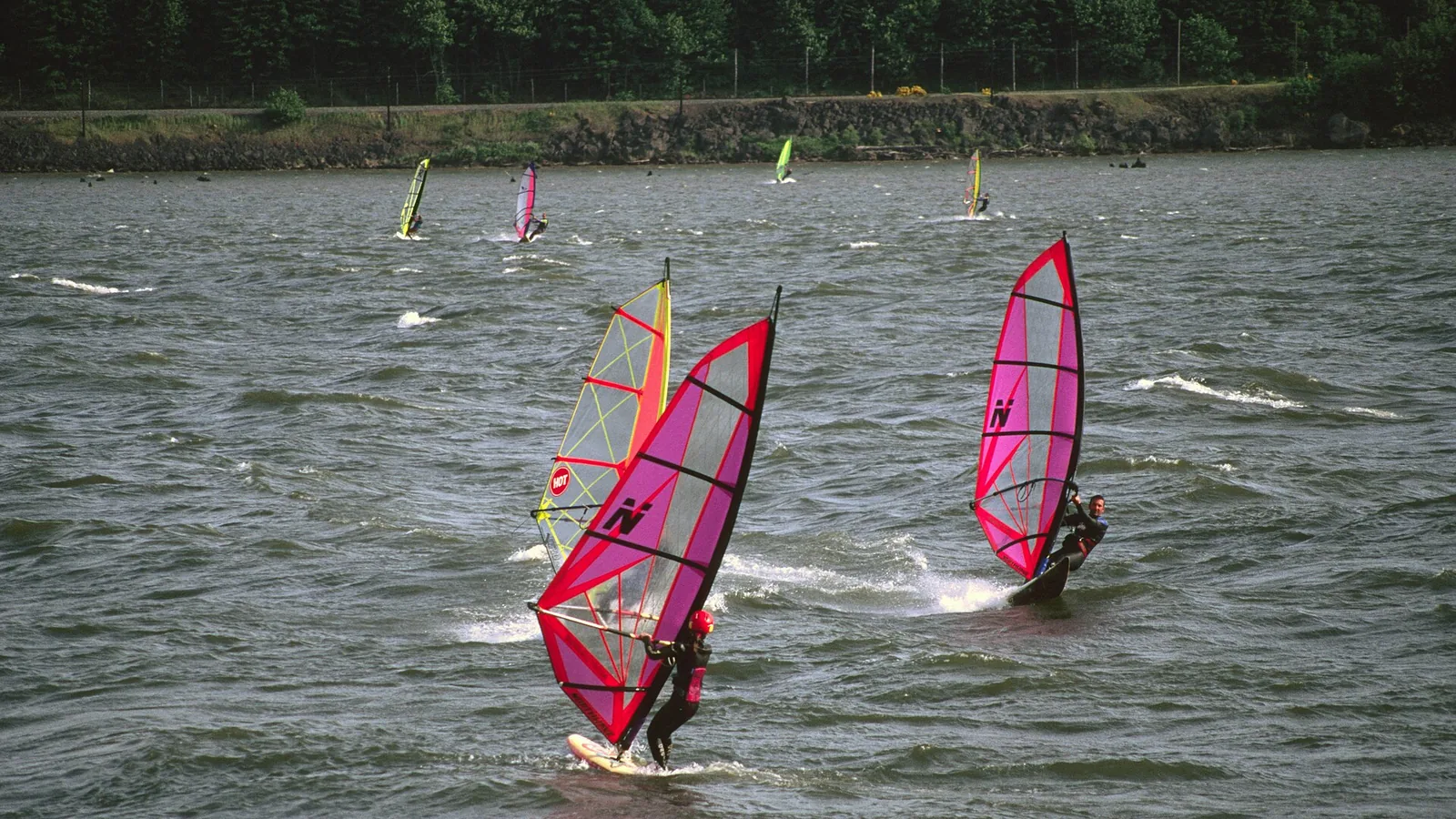
Photo: US Forest Service, Pacific Northwest Region / Wikimedia Commons, public domain
The Gorge is a single piece of physics you can plan a whole trip around. The coast is a different sport in different water.
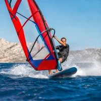
Hood River, Mosier, Rowena, Rufus, Arlington — wind against current, and swell on a river.
The Gorge in detail arrow_forward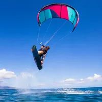
Floras Lake to learn on, Pistol River for experts, and surf that is best in winter.
The Oregon coast arrow_forward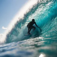
Not the Scenic Area — the Port ordinance, the plover closure and the barges.
Regulations arrow_forwardThe Columbia River Gorge is the only near-sea-level gap through the Cascade Range. West of the mountains sits a cool, moist marine airmass; east of them is the hot, dry Columbia Basin. That difference creates a west-to-east pressure gradient, and air accelerates through the gap to relieve it. The mechanism is properly documented in the meteorological literature, not just in spot guides.
In summer the basin is far hotter than the coast, so the gradient drives air eastward, up-river — against a river flowing west. That is the whole trick. Wind blowing upriver against a downriver current stands the water up into short, steep swell, which is why Gorge sites are graded by how big the chop gets rather than by wind strength alone, and why this does not feel like sailing on a lake.
The wind builds after about 1 p.m. as the interior heats. The reliable season is May to September, most consistent June to August, with April and October as shoulders. In deep winter the gradient reverses: cold basin air drains west, giving cold easterlies that are strongest at the western end of the Gorge. That is why Rooster Rock is an autumn and spring site while Hood River is a summer one.
The Gorge straddles a state line, so the bank you launch from decides which state's rules apply. This matters more than it sounds, and it is widely got wrong: one widely-cited launch directory has its bank labels systematically inverted, placing four Oregon sites in Washington and five Washington sites in Oregon. We checked each against the relevant state park, county or Forest Service source.
| Launch | Bank |
|---|---|
| Rooster Rock, Viento, Koberg Beach | Oregon |
| Hood River Waterfront, Event Site, the Hook, the Spit | Oregon |
| Mosier (Rock Creek Park) | Oregon |
| Rowena / Mayer State Park | Oregon |
| Celilo Park, Rufus, Arlington | Oregon |
| Stevenson, Bob's Beach, Home Valley | Washington |
| Swell City, the Hatchery | Washington |
| Doug's Beach, Lyle, Avery | Washington |
| Maryhill, the Wall, Roosevelt | Washington |
Threemile Canyon and Blalock are almost certainly Oregon — both sit on the I-84 corridor — but we could not confirm the bank from a primary source, so we are not asserting it.
The Spit (also called the Sandbar) is the kite beach; the Event Site grass is the windsurf and wing rigging area. A sandbar creates a waist-deep upwind zone that makes this unusually forgiving for a river spot — which is why sources describe the skill level differently depending on which part they mean. Both are right: the shallow inside is manageable early on, the current outside is not.
The Hook is the protected cove and the classic beginner windsurf venue — flat, sheltered, and by ordinance closed to kiteboarding entirely. Waterfront Park, just along, is city land rather than Port land, so a different set of rules applies there.
The serious hazard at Hood River is commercial: barge lanes run just past the end of the sandbar toward the Washington side, and the barges are up to 500 feet long. More on that below — it is the one thing on this page most likely to kill someone.
These get progressively windier, more current-swept and less forgiving. Mosier's own city page is blunt: "This is an advanced launch site, and NOT suitable for novices." Rowena is advanced with a launch that spot guides call sketchy for kites specifically. Rufus works when the western end is clouded in, and sits in strong current over slippery river rock. Arlington is experts-only — a rocky launch straight into the swell — though the Port there has built two groins to form a small protected harbour.
At several Gorge launches, crossing the railroad tracks is illegal. Union Pacific runs the Oregon bank and BNSF the Washington bank, and both are live freight lines.
The exception on this page. A freshwater lake sitting just behind the foredune, so it gets the summer north-westerly without the surf — sandy bottom, waist-deep at the top end, and genuinely the best place in Oregon to learn to kite or windsurf. April to October, roughly 15 to 25 knots from midday. No rips, no current; the main complaint is holes in the wind that make it feel gusty.
The opposite end of the scale: expert wave sailing, and the venue for the Pistol River Wave Bash, run every June since 2009 and now the US Wave Championships on the international tour. Cold water, medium-to-strong ocean wind, starboard tack, right-hand breaking waves over a beach break described as poundy and walled up. No source we found treats this as a kite spot or as anything a beginner should attempt.
Short Sand ("Shorty's") in Oswald West State Park is the north coast default — a protected cove whose headlands shelter it from wind, so it stays cleaner than the exposed beaches. It costs you a half-mile walk in from the car park with your board under your arm. Pacific City / Cape Kiwanda splits by end: smaller and friendlier at the north end, bigger and for experienced surfers at the south. Otter Rock, near Newport, is the state's best-known beginner break.
Oregon's beaches are, unusually, all public. The 1967 Beach Bill created a perpetual public recreation easement over the entire ocean shore — all 362 miles of it, between extreme low tide and the vegetation line, regardless of who owns the land behind.
This is the most common misconception about the Gorge, and it has a clean answer. The Columbia River Gorge National Scenic Area Act of 1986 created a land-use regime — management areas, a bi-state commission, a plan the counties implement in their zoning. Its own savings clause puts the water outside its reach: the Act states that nothing in it shall affect the rights or jurisdictions of the United States, the states, Indian tribes or others over the waters of any river or stream, or interfere with transportation on them, and that nothing in it affects any tribal treaty rights.
So the Scenic Area governs what gets built on the shore, not what you do on the river. The rules that actually bind a rider come from the Port, the state parks, the city and the navigation rules.
Adopted in December 2025, replacing the 2023 ordinance. The provisions that matter to a rider:
The practical consequence is that at Hood River you follow the posted signs. The Spit is the de facto kite beach and is used under signage rather than being named as a kite area in the ordinance text, so we are not going to tell you kiting is permanently allowed there — we are going to tell you to read the sign.
Worth saying plainly, because guides muddle it. Port parking runs at $2.75 an hour with a $15 daily maximum; an annual pass covering the Event Site and the main lots is $225 for a vehicle up to 20 feet, $350 over. Non-payment at the Event Site carries a $50 fine, overnight parking $90. Access to the water itself is free. Commercial schools pay concession permits in the thousands; riders do not.
For the state parks — Rooster Rock, Viento, Mayer/Rowena — Oregon charges a day-use parking permit: $10 for residents, $12 for non-residents, or $60 / $75 for a year. Arrive on foot, by bike or by bus and it is free; the fee is for the car, not for you. At Mosier, Rock Creek Park is $5 a day or $30 for the season, bought at the Mosier Market.
The Columbia is a working river with no vessel traffic service — nobody is sequencing traffic for you. A towboat covers a mile in about seven minutes and needs three-quarters to one and a half miles to stop. Blind spots extend hundreds of feet ahead of a tow. The danger signal is five or more short blasts, and commercial traffic monitors VHF 14 and 16.
Under the inland navigation rules, a vessel under 20 metres or a sailing vessel must not impede a vessel that can only safely navigate within a narrow channel. Whether a kiteboard is legally a "vessel" for that rule is not something we could establish — but the practical duty is not in doubt. The authorised channel between Vancouver and The Dalles Dam is 300 feet wide, and in some reaches the navigable channel runs bank to bank. Conflict between commercial traffic and board riders is explicitly identified as the main recreational conflict on this river.
For anyone bringing a kite to the Oregon coast, this is the regulation to know. From 15 March to 15 September every year, within designated snowy plover management areas — roughly 40 miles of the 362-mile shoreline — Oregon Parks prohibits dogs even on a leash, bikes, vehicles, kites and drones, across the entire dune area and the wet sand. Foot traffic is allowed on wet, hard-packed sand only.
Managed areas include Clatsop Spit, Nehalem Spit, Bayocean Spit, Netarts Spit, Sitka Sedge, the Sand Lake area and Bandon State Natural Area. We are deliberately not listing Nehalem Bay as a kite spot, although some kite guides do: the closure covers the spit for six months of the year and we could not establish how the two are meant to be reconciled. Check the state's current map before you travel.
Marine reserves do not restrict surfing. Oregon's five reserves — Otter Rock, Redfish Rocks, Cape Perpetua, Cascade Head, Cape Falcon — prohibit take of fish and wildlife and the deployment of fishing gear. The rule says nothing about surfing, paddling, swimming or diving. Otter Rock being a reserve does not stop you surfing it.
Kiteboards and sailboards are exempt from Oregon's Waterway Access Permit, along with surfboards. Stand-up paddleboards are not — they count as boats, needing the permit plus a wearable life jacket per person and a sound device. Children 12 and under must wear a life jacket on any paddlecraft.
State rules for the ocean shore prohibit launching surfboards from Avenue U north in Seaside, and prohibit launching rigid watercraft within the city limits of Seaside and Cannon Beach except by city permit. At Cannon Beach, city lifeguards may restrict the launching of inflatables case by case.
The 147 miles of river between Bonneville Dam and McNary Dam are Zone 6, an exclusive treaty Indian commercial fishing area. That reach contains every Oregon Gorge launch on this page except Rooster Rock. The fishery belongs to four tribes — the Nez Perce, the Confederated Tribes of the Umatilla Indian Reservation, the Confederated Tribes of Warm Springs, and the Confederated Tribes and Bands of the Yakama Nation — and it is worked with set nets anchored in the river and dip nets from scaffolds along the bank.
Along Zone 6 there are also 31 in-lieu and Treaty Fishing Access Sites, set aside by Congress for fishers whose grounds were drowned by the dams. They are federal property for the exclusive use of tribal fishers from those four tribes; only three have any shared public facility. They have parking, docks, drying sheds and net racks, which is exactly why a visitor can mistake one for a general boat launch.
We want to be straight about the status of what follows. We could not find a single official tribal, CRITFC or federal publication giving windsurfers or kiteboarders specific instructions. The three points below are our advice, worked out from the fishery's documented gear and the sites' documented exclusive status — not a rule we are quoting:
Celilo Park is a free, USACE-managed launch with disorganised swell, and most guides list it as one line in a table. It sits beside Celilo Village and the drowned site of Celilo Falls — a fishing, trade and ceremonial centre used for thousands of years by the Wy-am and by the Yakama, Umatilla, Nez Perce and Warm Springs peoples.
On 10 March 1957 the gates of The Dalles Dam closed and the falls and the village went under in roughly four and a half hours. Compensation of $26.8 million was paid and treaty fishing rights were retained; tribal leaders have consistently described the payment as inadequate. The Celilo Longhouse still stands south of the interstate and is still in ceremonial use. If you sail there, it seems worth knowing what you are sailing over.
These are instrument means, not estimates — the river from a USGS gauge at The Dalles, the coast from a NOAA station at Newport.
| Month | Columbia at The Dalles | Coast at Newport |
|---|---|---|
| February | 4.1 °C | 9.0 °C |
| May | 13.4 °C | 11.4 °C |
| July | 20.7 °C | 11.2 °C |
| August | 21.9 °C | 13.1 °C |
| October | 16.6 °C | 13.3 °C |
| December | 7.4 °C | 11.7 °C |
Two things jump out. The river in August is warmer than the ocean ever gets — nearly 22 °C at The Dalles against a coastal peak of about 13 °C. And on the coast, the coldest water a surfer actually meets is in May, June and July, with minima around 8 °C, not in winter. That is summer upwelling: northerly wind pushes surface water offshore and cold water comes up from below. The warmest coastal month is October. Most travel writing has this backwards.
Offshore wave data says the rest: mean significant wave height runs 3.1–3.3 m from December to February, with maxima above 9 m, against 1.4 m in July and August. That is why Oregon's real surf is a winter sport and its beginner season is summer. We are not going to name a wetsuit thickness here — put the number into our wetsuit thickness guide instead, which keeps that figure in one place.
The Oregon coast's signature hazard, and the National Weather Service is unusually direct about it. There can be ten to twenty minutes of small waves immediately before a sneaker wave arrives. They run up the beach by at least 150 feet into dry sand, and "no place on the beach is too high for the wave to reach."
The related killer is the beach logs. They are waterlogged, weigh hundreds of pounds, and a single sneaker wave can lift and roll one. The Weather Service states plainly that log rolls have proven fatal. Recorded surf-zone deaths in Oregon include two people at Rockaway Beach on the same day in 2018 and two children, aged four and seven, at Falcon Cove on the same day in January 2020 — the classic pattern where one person goes in and another follows.
There is no general lifeguard service on the Oregon coast. Cannon Beach and Seaside have city lifeguards; the great majority of the shoreline is unpatrolled. Emergency number is 911, and the Coast Guard monitors VHF 16. On the river, Hood River County Sheriff runs a full-time marine patrol whose own description names windsurfing and kiteboarding as a main part of its work.
What riders ask most before heading to Oregon.
May to September for the summer westerly thermal, most consistent June to August, with April and October as shoulders. The thermal is absent in deep winter — that is east-wind season, and only really at the western end of the Gorge around Rooster Rock.
No. The Port's Ordinance 30 bans kiteboarding at the Hook outright. The Hook is the sheltered beginner windsurf cove. Kiting is permitted from the Marina Green and Marina Beach and wherever an official sign allows it — at Hood River the rules are sign-driven, so read the posted signs.
No permit for the water. You pay to park: Port of Hood River lots are $2.75 an hour to a $15 daily maximum, and Oregon state parks charge $10–$12 a day or $60–$75 a year for parking. Arriving on foot or by bike is free. Kiteboards, sailboards and surfboards are also exempt from Oregon's Waterway Access Permit, though paddleboards are not.
No. The 1986 Act governs land use on the shore, and its own savings clause states it does not affect jurisdiction over the waters of the river or any tribal treaty rights. What binds you on the water is the Port ordinance, the state park rules and the navigation rules.
Not in a snowy plover management area between 15 March and 15 September. The closure names kites explicitly, along with dogs, bikes, vehicles and drones, across the dunes and the wet sand — around 40 miles of shoreline. Check the state's current map before travelling.
The river gets genuinely warm — nearly 22 °C at The Dalles in August, warmer than the ocean ever gets. The coast sits between about 9 °C and 13 °C all year, and is coldest in May, June and July because of summer upwelling, not in winter. The warmest coastal month is October.
In an emergency, call 911. On the water, the US Coast Guard and commercial traffic monitor VHF 16, and working traffic on this river also uses channel 14.