


📍 Baja California Sur, Mexico
Photo: Purecabo / Wikimedia Commons, CC BY-SA 4.0
The Sea of Cortez side is wind. The Pacific side is surf. Neither is Cabo Pulmo, which is neither.
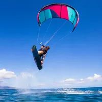
The East Cape's winter "El Norte" wind, on the Sea of Cortez — a short flight from Southern California and the Southwest, and US-run schools on the beach.
The wind coast in detail arrow_forward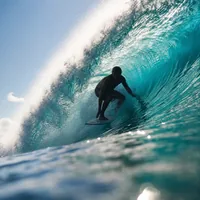
Real Pacific surf at Los Cerritos and San Pedrito — a beginner beach break and a heavier intermediate-advanced point, ten minutes apart.
The surf coast in detail arrow_forward
A federally protected marine park built for diving and snorkelling, with anchoring rules that matter if you're passing through by boat.
Read this before you go arrow_forwardTwo coasts, two seasons, and a Mexican jurisdiction — not a US one, despite the flight time.
La Ventana and Los Barriles sit across the Sea of Cortez from mainland Mexico, on what riders call the East Cape — roughly an hour's drive from La Paz for La Ventana, and about an hour and a half north of Los Cabos for Los Barriles. Both towns run on the same winter wind, known locally as "El Norte."
The mechanism, as best documented: specialist wind-forecasting sites (not a government meteorological agency — worth being plain about that) describe a winter storm crossing California, leaving a large high-pressure system to settle over the Great Basin and then the Four Corners. As it does, the isobars tighten down the length of the Sea of Cortez, and the resulting pressure gradient drives strong north-to-north-east wind the length of the Gulf. At La Ventana specifically, the same sources describe a local boost: the Los Planes valley behind the bay is walled by mountains on three sides, heats up during the day, and the rising air creates a local low that pulls wind harder toward the shore. We're reporting this as the forecasting community's own explanation, not as a peer-reviewed meteorological finding.
Season and strength are consistent across multiple independent kite-travel and school sources — not one figure repeated, several converging: roughly November through March, with December-February usually windiest, in the 15-30 knot range and stronger during a strong Norte event. Wind tends to fill in mid-to-late morning and hold through the afternoon. That range is commercial-tier sourcing (kite schools, wind-travel guides), not a national weather service figure, and it's presented that way rather than as a guaranteed forecast.
See La Ventana on Google Maps open_in_newLa Ventana is the flatter, more beginner-friendly bay of the two, with a protected inside area and open water further out for stronger riders. Evolution Kiteboarding runs kite, wing and foil lessons there through the winter season. Los Barriles, a short drive north, has open Sea of Cortez swell alongside the wind, and is home to ExotiKite Kiteboarding — a family-run school operating there since 1998, one of the longest-running kite operations on this coast — and Wahoo Wind Co., a beachfront kite and wingfoil school. All three schools were confirmed against their own official sites.
Neither town has a documented municipal ordinance specific to kiteboarding or windsurfing. We looked and found none — that's an absence of evidence, not proof one doesn't exist, and it means rules on the beach come down to operator self-regulation (launch windows, keeping clear of swimmers) rather than a written local rule. See the regulations section below for what federal law does say.
Cross the peninsula to its Pacific side and the sport changes completely — this is surf, not wind. Los Cerritos and San Pedrito, both near Todos Santos and El Pescadero, are the two named breaks, and they're genuinely different from each other despite sitting close together.
Los Cerritos is a sandy-bottom beach break, widely described by surf guides as beginner-to-intermediate and forgiving across most tides — the kind of wave a first-timer can actually stand up on. San Pedrito, a short drive away, holds a more powerful, hollower right-hander that surf-data sites describe waking up specifically on north-west groundswell, and it draws intermediate-to-advanced surfers rather than beginners.
The mechanism: winter North Pacific storms send long-period north-west to west-north-west groundswell onto this stretch of coast, with mornings often offshore or cross-shore (wind off the land) before an afternoon sea breeze fills in. Surf-forecast and surf-stat sites put the main season at roughly October through April, with January through March singled out as the most consistent stretch at Los Cerritos and October through March at San Pedrito. A secondary, smaller south-to-south-west swell adds in through late spring and summer, mixing in at south-west-facing beaches like San Pedrito. As with the wind mechanism above, this comes from surf-forecast and surf-shop sources rather than a government meteorological agency, and is presented that way.
See Los Cerritos on Google Maps open_in_newMario Surf School, based on the beach at Los Cerritos about ten minutes from the town of Todos Santos, runs lessons for beginners at that break and describes itself as operating year-round with a slower season roughly July-October. It's confirmed against its own site rather than a directory listing alone. Los Cabos International Airport (SJD) is the gateway for this coast, roughly an hour's drive from Todos Santos.
Cabo Pulmo comes up constantly in Baja California Sur searches, and it's worth being direct: it is not a documented kiteboarding or wind destination, and this page does not treat it as one. It's a federally protected national marine park, and its own management plan describes it in terms of diving and snorkelling around one of the Sea of Cortez's few living hard-coral reefs — not as a wind or wave sport venue.
That plan — CONANP's Programa de Conservación y Manejo: Parque Nacional Cabo Pulmo, whose summary was published via an Aviso in the Diario Oficial de la Federación on 13 November 2009 — bans anchoring outright in the park's two preservation subzones, and allows it only on sandy bottom within the sustainable-use subzone. We read the plan directly for this page rather than repeating a secondary summary: it names zero kite or wind activity.
If you're on this coast for wind or waves, Cabo Pulmo is worth a separate day trip for diving or snorkelling — not a stop on a kite or surf itinerary, and not somewhere to anchor a boat outside the sanctioned area.
Baja California Sur is Mexico — a genuinely international destination reached from the US, not a US state and not governed by US Coast Guard rules. It's also not Spain or France: none of this site's European coastal rules (a 300-metre limit, a specific mandatory-kit list) apply here, and we're not going to transplant one onto this page.
Mexico's maritime authority is SEMAR (Secretaría de Marina), administered locally through the Capitanía de Puerto — for this coast, the ports covering La Paz and Cabo San Lucas — under the federal Ley de Navegación y Comercio Marítimos.
We found no federal or state law requiring a life jacket to be worn by a kiteboarder, windsurfer or SUP rider who isn't aboard a registered vessel — the same documented gap this site has already found in several US states and elsewhere in Mexico. That's reported as "not found," not as "confirmed exempt": the honest answer where research comes back empty, per this site's own standing rule.
No local ordinance was found governing La Ventana or Los Barriles specifically. Rules on the beach in both towns come from the schools and operators themselves, not from a written municipal code we could locate.
In an emergency, dial 911 — unified nationally across Mexico since 2017. VHF channel 16 is the international maritime distress convention; we could not confirm a Mexico-specific SEMAR search-and-rescue channel to name instead.
What riders ask most before heading to Baja California Sur.
No — they're two different Mexican states. Baja California Sur is the southern state covering La Ventana, Los Barriles, Los Cabos and Todos Santos. Baja California, to the north, is a different state entirely (Tijuana, Ensenada). This page covers Baja California Sur only.
Kite and wind-travel sources consistently give roughly November through March, with December-February usually windiest, driven by a winter pattern known locally as "El Norte." That's commercial-tier sourcing (kite schools and wind-forecasting sites), not a government weather bureau figure.
No. Cabo Pulmo is a federally protected national marine park built around diving and snorkelling on a living coral reef. Its own management plan names zero kite or wind activity and bans anchoring outright in two of its subzones — don't plan a kite trip around it.
Los Cerritos, near Todos Santos — a sandy-bottom beach break widely described as beginner-to-intermediate. San Pedrito, a short drive away, is a heavier, hollower wave for intermediate-to-advanced surfers.
We found no federal or Baja California Sur state law requiring one for a kiteboarder, windsurfer or SUP rider not aboard a registered vessel. That's reported as a documented absence, not as confirmation there's no reason to wear one.
La Paz International Airport (LAP) is closest for La Ventana and Los Barriles; Los Cabos International (SJD) serves Los Cabos and Todos Santos. Both have direct flights from several Southern California and Southwest US cities.